Whether you’re planning a Dolomites trip with young children or elderly parents, or simply looking for an “easy on the legs” trail to tackle on a rest day between bigger, more challenging hikes, here are some of my top recommendations.
I define “easy” primarily in terms of terrain and technical difficulty. These trails generally follow wide, well-defined tracks with no exposure or technical sections. Many are relatively flat, but not all, so be sure to check the trail stats for each hike and choose the one that best suits your needs and fitness level.
Please note that time needed strictly signifies walking time without breaks.
And if you’re traveling with someone with limited mobility or an injury, read my Dolomites for Non-Hikers guide.

- Best Base: Where to Stay in the Dolomites
- Where to Go: Places to Visit in the Dolomites
- What to Do: Things to Do in the Dolomites
- Getting Here: How to Get to the Dolomites
- Car-Free Travel: How to Visit the Dolomites Without a Car
- When to Visit: Best Time to Visit the Dolomites
- Honeymoon Tips: Dolomites Honeymoon
Val Pusteria Easy Walks
Val Fiscalina / Fischleintal Walk

Accessible all-year-round, the Val Fiscalina valley trail offers plenty of reward for very little effort. This side valley of Valle di Sesto (Sextental) leads to the base of Cima Una (Einserkofel) in the Northern Sexten Dolomites.
Starting in Moos, a gentle path winds through a larch meadow to the Fischleinbodenhütte car park and Dolomitenhof hotel. From here, the trail continues along a gravel track to Talschlusshütte, all the while facing the Sexten Sundial.
To extend this hike, start in the village of Sexten. To shorten this hike, drive or take the bus to Fischleinbodenhütte.
Trailhead | Croda Rossa/Rotwand gondola car park/bus stop
Distance | 7.8 km out-and-back
Time Needed | 2 hours
Elevation Gain/Loss | 174 meters
Where to Stay | See Where to Stay in Sexten
Monte Specie / Strudelkopf Summit Hike

Monte Specie (Strudelkopf in German) is an easy-to-reach summit in the Braies Dolomites, high above Valle di Landro (Höhlensteintal), which commands a stunning view of Tre Cime di Lavaredo, Cadini di Misurina, and the Cristallo Group.
This straightforward hike starts atop the Prato Piazza / Plätzwiese high plateau (2000 m), accessible by bus or car (see current restrictions) from Braies Valley.
From Rifugio Prato Piazza, the trail crosses alpine meadows and gently ascends to the summit. Return to the starting point via Rifugio Vallandro and the hut access road.
Trailhead | Prato Piazza Car Park
Distance | 8.8 km circuit
Time Needed | 3 hours
Elevation Gain/Loss | 389 meters
Where to Stay in Braies Valley | Garni Bergblick (B&B), or Berggasthaus Agritur Moserhof (farm stay)
Plan Your Trip to Val Pusteria
Easy Walks in Val Badia
Armentara Plateau
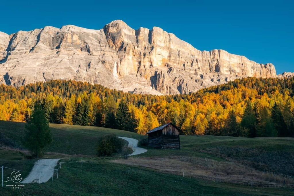
Armentara Plateau is a vast meadowscape at the foot of Sas dla Crusc on the edge of the Fanes-Sennes-Braies Nature Park.
The plateau can be reached on foot from La Val, San Cassiano, La Villa, and Badia. The easiest approach, however, is from Badia, taking the La Crusc 1 & 2 gondolas up to the La Crusc Pilgrimage Church and Rifugio La Crusc.
From here, a gravel path winds gently downhill towards the Armentara Plateau, crossing a succession of scenic meadows along the way. The farm road continues to Ranch da Andrè, a managed hut, before descending to San Linert and eventually back to the valley station.
Throughout the walk, Sas dla Crusc dominates the landscape, a dramatic fortress of rock rising above rolling hay meadows. The contrast between the rugged mountain and the soft, open pastureland makes this one of the most enchanting landscapes in the Alta Badia.
Though this is an easy hike, 800 meters of downhill walking can be difficult for many.
If you’re traveling with children, there’s a family park and two huts at the middle station.
Trailhead | La Crusc Church
Distance | 9 km point-to-point
Time Needed | 3 hours
Elevation Gain/Loss | 800 meters
Where to Stay in Badia | Hotel Cavallino (3-star hotel), or Residence Lersc (apartments)
Pralongia Plateau
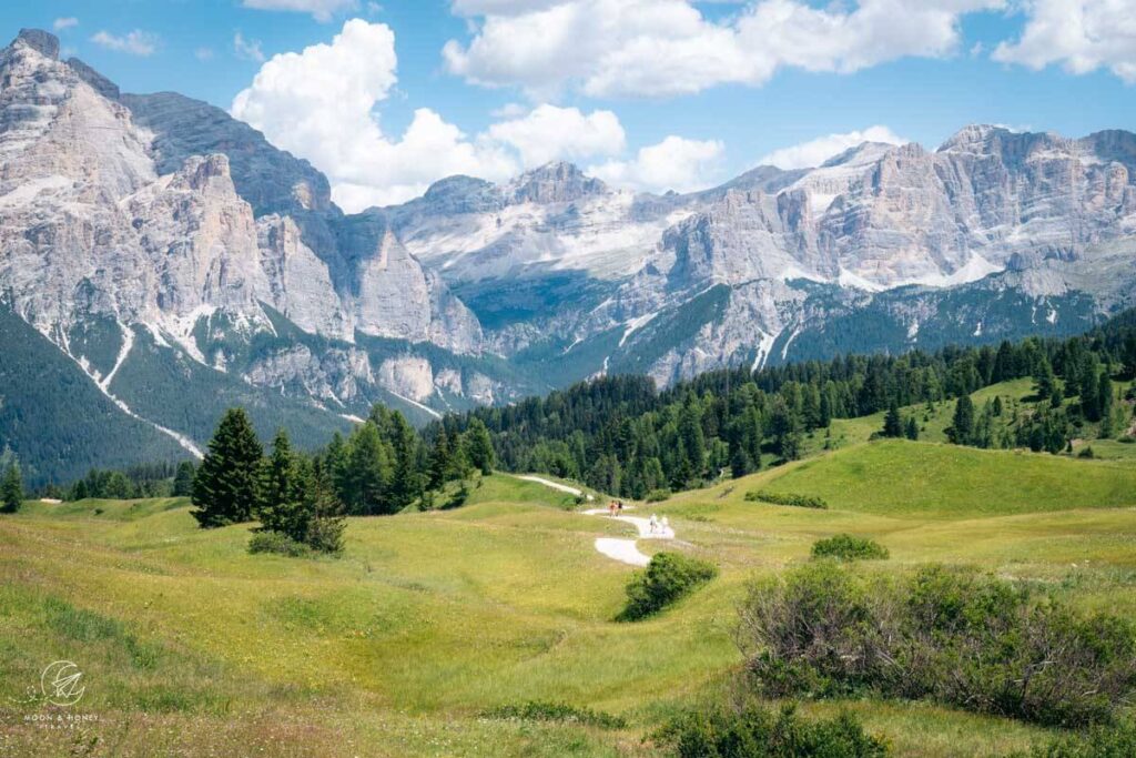
Pralongia plateau, the main ski area of the Alta Badia ski resort, attracts walkers and mountain bikers in summer. You can access the plateau swiftly by gondola from San Cassiano (Piz Surega lift), Corvara (Col Alt lift), or La Villa (Piz la Ila lift).
For an “easy on the legs” day, I recommend riding the Piz Surega lift and hiking to Rifugio Ütia Bioch. Continue the hike to Rifugio Alpino Pralongià and then descend to San Cassiano via Rifugio Malga Saraghes along trail 22.
This is a variation of my Störes Meadows hike.
Trailhead | Piz Surega cable car mountain station
Distance | 10 km
Time Needed | 3 hours
Elevation Gain | 170 meters
Elevation Loss | 608 meters
Where to Stay in San Cassiano | Ciasa Milandura (apartments) or Lagacio Mountain Residence (aparthotel)
Colfosco High Trail
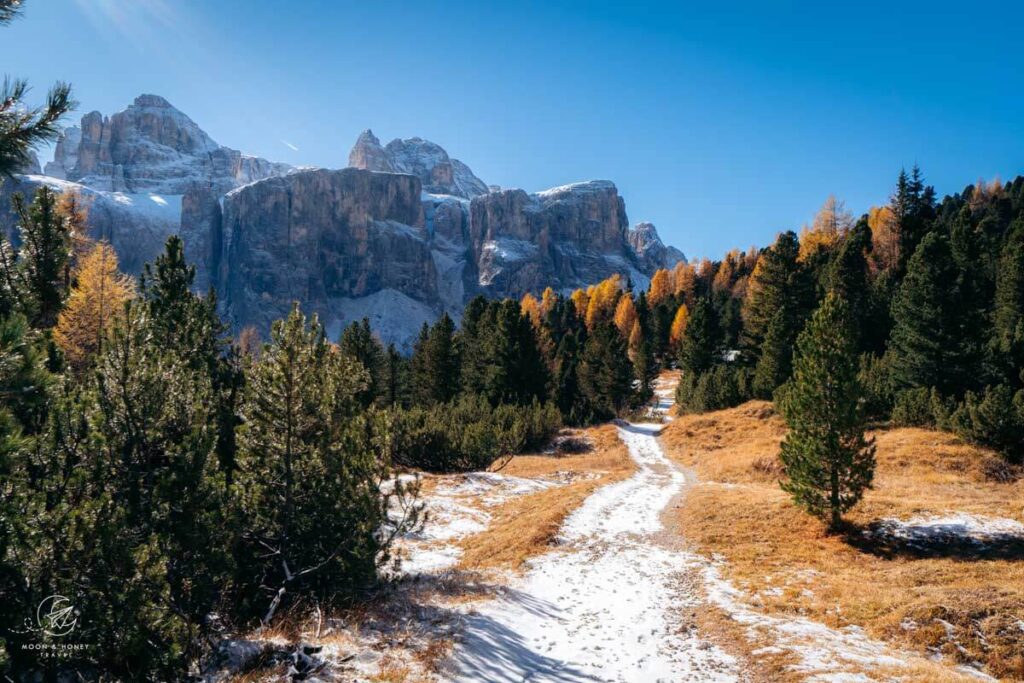
The Colfosco High Trail (aka Kolfuschg High Trail) connects Edelweiss Valley in Colfosco with Passo Gardena. You can ascend the path to Passo Gardena and return to Colfosco by bus, or reverse, if you prefer to walk downhill.
This trail runs along the base of the Cir Group, but its main appeal lies in the sweeping views of the Sella Group.
Either eat at Jimmy Hütte or Edelweiss Hütte.
Starting Point | Colfosco
Ending Point | Passo Gardena
Distance | 6.5 km point-to-point
Time Needed | 3 hours
Elevation Gain | 547 meters
Elevation Loss | 67 meters
Where to Stay in Colfosco / Corvara | Crëp Sella (3-star hotel), or Movi Family Apart-Hotel (family-friendly hotel)
Ütia Da Rit
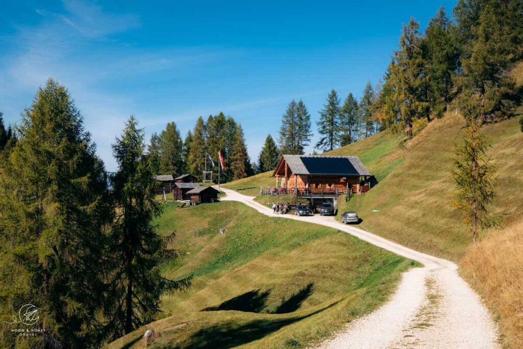
Ütia Da Rit is a charming alpine pasture hut that serves very delicious Ladin-South Tyrolean food at the base of Pares Peak above La Val. The way from Ciurnadù car park (pre-book parking in high season) to the Rit Meadows exclusively follows a wide forest road.
Trailhead | Ciurnadù, La Val
Distance | 8 km out-and-back
Time Needed | 2:45 hours
Elevation Gain/Loss | 416 meters
Where to Stay in La Val | La Palsa (3-star hotel), or Hotel Plan Murin (3-star adults-only)
Passo delle Erbe to Munt de Fornella
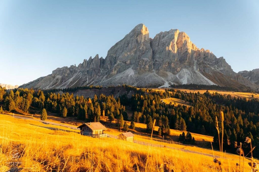
Passo delle Erbe connects Val di Funes and Val Isarco with Val Badia. It’s the starting point of the stunning Sass de Putia circuit trail, which is probably too taxing for small kids. However, you can take in the beauty of Sass de Putia, the northernmost massif of the Dolomites, by simply walking the gravel path from the pass to the Munt de Fornella alpine pasture hut at the base of the mountain.
Trailhead | Passo delle Erbe Paid Car Park (arrive early, because it fills up quickly)
Distance | 2.5 km out-and-back
Time Needed | 45 minutes
Elevation Gain/Loss | 78 meters
Where to Stay near Passo delle Erbe | Ütia de Börz (3-star refuge) or Edelweißhütte (budget-friendly)
Plan Your Trip to Val Badia
Easy Walks in Val Gardena
Vallunga Valley

Flanked by vertical cliffs on both sides, Vallunga is a side valley of Val Gardena that leads northeast from Selva di Val Gardena into the Puez Group. I recommend hiking to Pra da Ri out-and-back, or a shorter variation.
If someone in your group wants to embark on a longer, more strenuous hike, check out my Val de Chedul and Vallunga circuit trail.
Trailhead | Vallunga Paid Car Park
Distance | 6.5 km out-and-back
Time Needed | 1:50 hours
Elevation Gain/Loss | 183 meters
Where to Stay in Selva | Garni Sunela B&B, Garni Morene, and Garni Hotel Mezdi.
Resciesa Plateau to Rifugio Brogles

The Resciesa High Plateau rises between Val di Funes and Val Gardena. From Ortisei in Val Gardena, ride the funicular to the plateau, which usually operates between end of May and mid-October. From the mountain station, follow Trail 31 and later Trail 35 to Brogles Sattel and and onwards to Brogles Hütte.
The route is especially spectacular thanks to its sweeping views of the jagged Odle/Geisler Peaks, which increasingly dominate the landscape as you progress. You may encounter grazing donkeys along the way.
Trailhead | Resciesa Funicular mountain station
Distance | 9.6 km out-and-back
Time Needed | 2:50 hours
Elevation Gain/Loss | 300 meters
Where to Stay in Ortisei | Residence Cesa Sassela (aparthotel), Casa al Sole (B&B, read my Casa al Sole review), or Boutique Hotel Planlim (3-star hotel)
Plan your trip to Val Gardena
- Best Val Gardena Hotels
- Best Hikes in Val Gardena
- Seceda Travel Guide
- Alpe di Siusi Travel Guide
- Val Gardena Summer Itinerary
Easy Walks in Val di Funes
Santa Maddalena Panorama Trail
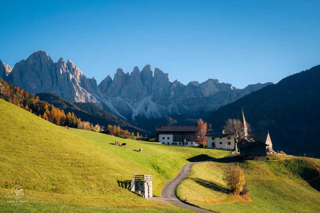
Santa Maddalena (St. Magdalena in German) is a village in Val di Funes home to the historic Santa Maddalena Church, which is one of the most popular photo motifs in the Dolomites. It’s also the start of an excellent panoramic hike.
This Santa Maddalena panorama trail weaves through meadows, pockets of forest, and historic farmsteads. There are stunning views of the Odle Peaks rising above the valley throughout.
Trailhead | Santa Maddalena Village
Distance | 9.5 km circuit
Time Needed | 3:30 hours
Elevation Gain/Loss | 380 meters
Where to Stay in Val di Funes | Fallerhof (budget), Hotel Fines (midrange), Proihof (midrange), or Hotel Tyrol (luxury)
Plan your trip to Val di Funes
Easy Walks in Arabba & Val di Fassa
Sentiero Viel del Pan
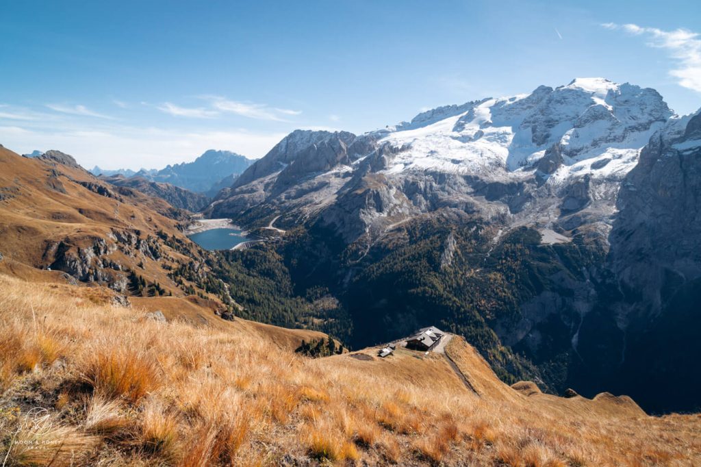
Sentiero Viel del Pan (Bindelweg in German) is a hiking trail that crosses the southern slopes of the Padon chain from Passo Pordoi to Lago di Fedaia. This hike is extremely popular due to its unbeatable views of Marmolada, the highest mountain in the Dolomites.
After a 167-meter ascent to Rifugio Fredarola, the trail eases and continues to Rifugio Viel del Pan. I recommend hiking to this hut out-and-back.
We hiked this Viel del Pan & Alta Via Della Cresta Circuit Trail, which is a bit more adventurous.
Trailhead | Passo Pordoi
Distance | 6.7 km out-and-back
Time Needed | 2:15 hours
Elevation Gain/Loss | 210 meters
Where to Stay in Arabba | Hotel Garni Marilena (B&B)
Where to Stay in Val di Fassa | Hotel Cesa Tyrol (4-star hotel)
Dolomites Travel Guides
Road Trip Routes:
- 5-Day Dolomites Road Trip
- 7-Day Dolomites Road Trip
- 10-14 Day Dolomites Road Trip
- Munich to Dolomites Road Trip
Pin this Image for Future Trip Planning!
Stay Connected:
Connect with us on Pinterest.
Follow us on Instagram.
Like us on Facebook.
Support Us:
If you love reading my content, you can send me a direct donation.



My wife and I are thinking of spending time in Santa Maddelena next summer. Perhaps around 4 to 5 days. It’s absolutely beautiful! We are in our late 60’s and really appreciate the easy hiking guide. Other than the Panorama trail are there some more “easy on the legs” hikes you would recommend? We will have a car and can drive to other areas nearby, we just like to base in one area. The two of you have created a wonderful website! Thank you for sharing!
Best,
Toby and Patsy
Hi Toby and Patsy,
The Adolf Munkel Trail isn’t that strenuous, though it involves nearly 400 meters of elevation gain/loss.
There are several hikes on Plose that might be suitable – I hope to know more by the end of this season. We send out our new guides to our newsletter subscribers. You can sign up here. Just make sure to confirm your email in your inbox.
You can also drive up to Passo delle Erbe and walk to Munt de Fornella (short walk).
You may also want to consider Alta Badia as a base:
Störes Meadows hike with Piz Surega gondola variation
Armentara Meadows
Pisciadu Waterfall Walk
Kindly,
Sabrina