Val Gardena, the Dolomites valley that stretches from Gardena Pass and Sella Pass to Valle Isarco, is the ultimate base for hiking around the Sassolungo and Sella Groups, across the Resciesa and Alpe di Siusi plateaus, and in Puez-Odle Nature Park.
With so many beloved hiking destinations at its doorstep, Val Gardena offers countless hiking options, ranging from easy walks to heart-pumping summit climbs. And because Val Gardena is a well-established ski region, a network of cableways and gondolas makes hiking here even more accessible.
An added bonus of staying and hiking in Val Gardena is the free transit system for overnight guests, ideal for travelers visiting the Dolomites without a car.

- Where is Val Gardena: South Tyrol, Northern Italy
- When to Hike in Val Gardena: June – October
- How to Get to Val Gardena: How to Get to the Dolomites
- Where to Stay: Best Hotels in Val Gardena
- Recommended Itineraries: 5-Day Dolomites Itinerary, 7-Day Dolomites Itinerary, or 10-14 Day Dolomites Itinerary
- Recommended Trail Map: Tabacco 05 Val Gardena – Alpe di Siusi
Val Gardena Hiking Map
Val Gardena encompasses the towns Ortisei, Selva di Val Gardena, and Santa Cristina. Because this is a German-, Ladin-, and Italian-speaking region, each town, nature park, mountain hut, etc… has three names. So, Ortisei is also called St. Ulrich and Urtijëi. Selva di Val Gardena is also called Wolkenstein and Sëlva.
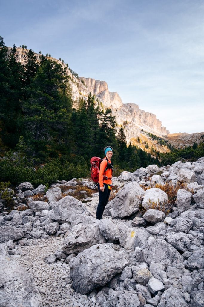
1. Seceda Ridgeline to Rifugio Firenze (Regensburger Hütte) Circuit Trail

The Seceda ridge is one of the most striking and awe-inspiring destinations in the Dolomites. You’ve seen the photo a million times. And, yet it’s even more spectacular in person.
There are several ways to hike to Seceda, which I’ve outlined in my Seceda guide. One of my favorite routes begins at the Seceda mountain station, reached via the Ortisei-Furnes-Seceda cableways. From there, a short ascent leads to the summit, where a spectacular ridge trail unfolds along the mountain’s edge toward the dramatic, dagger-like Odle peaks.
The hike continues to the twin spires of the Pieralongia mountain pasture. Facing Monte Stevia, the trail descends to Rifugio Firenze, a great place for a break. The return to the Seceda mountain station is mostly uphill, which sometimes comes as a surprise after all the downhill walking.
Very ambitious hikers and via ferrata climbers can summit Sass Rigais (Grade B/C).
Trailhead | Seceda cableway mountain station
Distance | 8.9 km circuit
Time Needed | 3:00 – 3:30 hours
Elevation Gain/Loss | 575 meters
Difficulty | Easy – Moderate
Where to Stay in Ortisei | Casa al Sole (Read my Casa al Sole review)
Learn More: Seceda to Rifugio Firenze Circuit Hike
2. Resciesa – Rifugio Brogles – Seceda

The Resciesa-Seceda route is one of the most exhilarating, and also most demanding, hikes in the area. It begins with a funicular ride from Ortisei to the Resciesa plateau. From there, the trail traverses the plateau on mostly level terrain before gently descending to Malga Brogles, set in a dramatic position beneath the Odle peaks in Val di Funes.
From the hut, the route follows the Adolf Munkel Trail along the base of the Odle Group, before turning sharply upward to cross the range via Furcela de Mesdi (Mittagsscharte, trail 29). This section is steep, rugged, and physically demanding, with loose scree and rocky footing throughout.
From the narrow saddle, the path descends to a meadow, then continues to the Pieralongia alpine pasture and climbs up to the Seceda ridge. From here, you can either descend to Ortisei via the Seceda-Furnes-Ortisei cableways, or continue hiking to the Col Raiser gondola station and descend to Selva or Santa Cristina.
Starting Point | Resciesa Funicular mountain station
Ending Point | Seceda Cableway mountain station
Distance | 14.4 km point-to-point
Time Needed | 6:15 hours
Elevation Gain | 1087 meters
Elevation Loss | 737 meters
Difficulty | Difficult
Where to Stay in Ortisei | Casa al Sole (B&B), or Boutique Hotel Planlim (3-star hotel)
Learn More: Hiking from Resciesa to Seceda
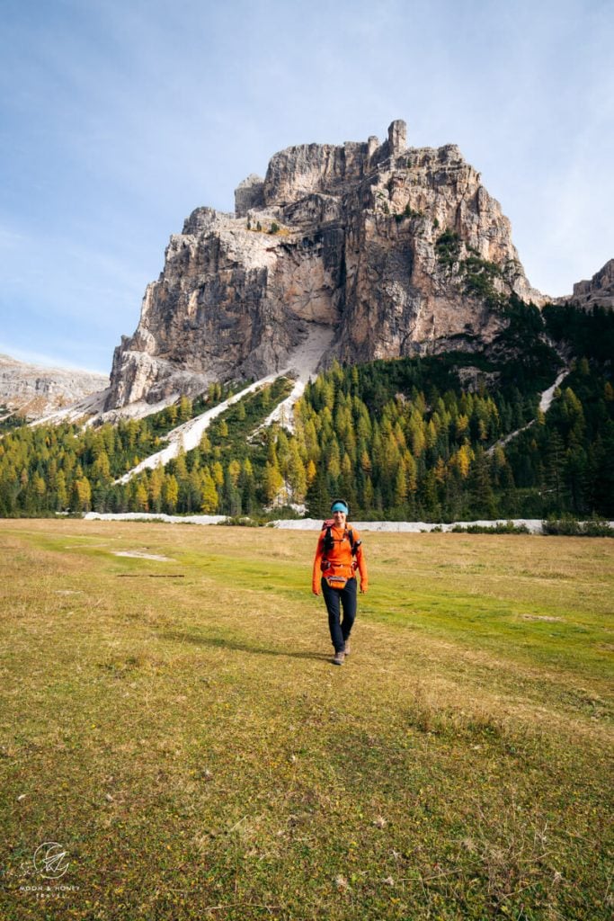
3. Col dala Pieres Summit Hike

It’s nearly impossible to choose a favorite hike in Val Gardena. But if pressed, this route to Col dala Pieres would be a strong contender.
Starting at the Col Raiser mountain station, the trail leads to Rifugio Firenze (Regensburger Hütte). From here, pick up trail 17B and begin the challenging ascent to Forcella Piza (2489 m), the saddle between Muntejela and Mont de Stevia.
Once on the Stevia plateau, the path continues left toward the summit of Col dala Pieres. Before committing to the final climb, it’s well worth detouring right to Rifugio Stevia for hearty South Tyrolean fare and sweeping views of the Sassolungo, Sella, and Cir groups.
The ascent to Col dala Pieres is relatively straightforward, but the descent toward Forcella Forces de Sieles is more technical and exposed, requiring a steady footing and a good head for heights. As you exit the Forces de Sieles gully, the perspective of the Odle (Geisler) peaks is particularly striking from this angle.
Trailhead | Col Raiser gondola mountain station
Distance | 13.7 km lollipop-circuit
Time Needed | 6 hours
Elevation Gain/Loss | 1220 meters
Difficulty | Difficult
Where to Stay in Selva | Hotel Rodella (4-star hotel), Hotel Jägerheim (3-star hotel)
Learn More: Col dala Pieres Day Hike
4. Piz Duleda Summit Hike

Piz Duleda (2909 m), a prominent summit in the Odle Group, is one of the more adventurous hiking destinations in Val Gardena.
Like Col dala Pieres, this quiet route begins at the Col Raiser gondola mountain station, climbing steadily through the quiet Val dla Roa valley to the Furcela dla Roa (Roa Scharte) saddle. From there, the trail continues along the Sentiero Attrezzato Piz Duleda, a protected path (Grade A), leading to the Furcela Nives saddle.
From Furcela Nives, the ascent to the summit of Piz Duleda is straightforward. The descent follows a dramatic traverse beneath crumbling rock towers to Furcela Forces de Sieles, where it joins the Col dala Pieres route, before dropping steeply down the scree-filled Forces de Sieles gully. With striking views of the sawtoothed Odle peaks, the terrain gradually eases as the trail returns to Rifugio Firenze.
Trailhead | Col Raiser Gondola Mountain Station
Distance | 12.4 km lollipop-circuit
Time Needed | 5 hours
Elevation Gain/Loss | 980 meters
Difficulty | Difficult
Where to Stay in Selva | Hotel Rodella (4-star hotel), Hotel Jägerheim (3-star hotel)
Learn More: Piz Duleda Trail Guide
5. Vallunga and Val de Chedul Circuit Trail
Val de Chedul and Vallunga are two neighboring valleys in Puez-Odle Nature Park, both accessible from the Vallunga car park in Selva di Val Gardena.
Vallunga is an excellent year-round hiking destination. A wide, easy path runs through the valley between dramatic rock walls, making it ideal for a relaxed out-and-back walk, especially for families with children.
Val de Chedul, by contrast, feels far wilder, with steeper, more rugged terrain. To experience both landscapes in one outing, ascend the quieter Val de Chedul to the Puez-Odle plateau, then traverse to Rifugio Puez. From there, descend into Vallunga and follow the valley floor all the way back to the starting point.
Trailhead | Parcheggio Vallunga Car Park
Distance | 16.1 km circuit
Time Needed | 6 hours
Elevation Gain/Loss | 1061 Meters
Difficulty | Moderate – Moderately-Difficult
Where to Stay in Selva | Garni Sunela (B&B), Garni Morene (guesthouse), Hotel Continental Dolomites (4-star hotel)
Learn More: Vallunga and Val de Chedul Circuit Hike
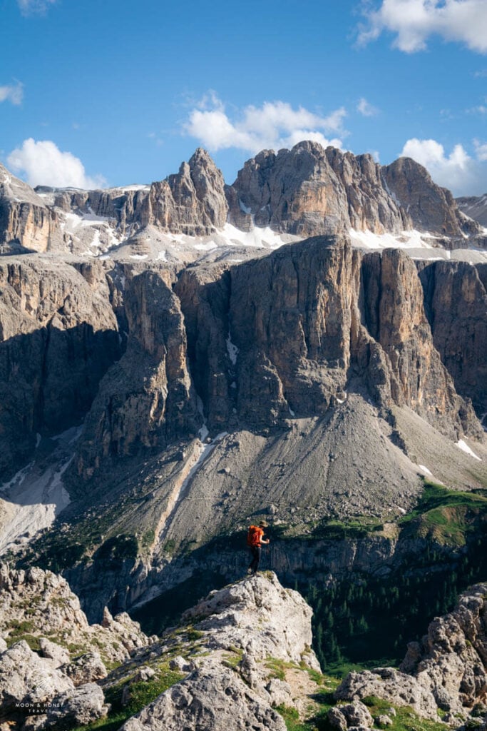
6. Sassolungo Circuit Trail

The Sassolungo (Langkofel in German, Saslonch in Ladin) Group is a compact mountain group situated between Val Gardena and Val di Fassa. At Passo Sella, a long circuit trail loops around the whole group.
Hiking clockwise, you’ll initially follow the Friedrich August Weg (trail 557) to the Rifugio Friedrich August hut, Rifugio Sandro Pertini Hut, and onwards to Rifugio Sass Piatto. Along this undulating stretch, you’ll see Marmolada, the highest mountain in the Dolomites, Val di Fassa, and the Catinaccio mountains.
From the refuge at the base of Sasso Piatto, the circuit continues north on trail 527, with an outlook over Alpe di Siusi. Following the northern slopes of the Sassolungo Group, the trail crosses meadows and pockets of forest. There’s an opportunity to detour to Rifugio Vicenza/Langkofel Hütte, before continuing on trail 526 to Rifugio Comici.
The final leg to Passo Sella traverses the enchanting landscape of Citta dei Sassi/Steinerne Stadt, which means City of Stone.
Experienced via ferrata climbers may want to hike the Via Ferrata Oskar Schuster instead.
Trailhead | Passo Sella
Distance | 17.7 km circuit
Time Needed | 6:15 hours
Elevation Gain/Loss | 853 meters
Difficulty | Moderate
Where to Stay at Passo Sella | Hotel Passo Sella Dolomiti Mountain Resort
Learn More: Sassolungo Circuit Trail
7. Juac Hütte – Steviola Plateau Circuit Trail
The hike to Steviola Plateau, a favorite amongst locals, is probably the best kept secret in Val Gardena. Here, hikers can enjoy sweeping views of Sella, Cir, and Sassolungo in solitude, an increasingly rare experience.
This fine circular tour starts at the Daunëi Sciuz bus stop high above Selva di Val Gardena. From here, the trail ascends towards Juac Hütte, continues over the Silvesterscharte (Furcella San Silvestro) to reach Steviola. The descent traces the steep, timber-bolstered Palota trail.
Trailhead | Daunëi Sciuz
Distance | 6 km circuit
Time Needed | 3:30 hours
Elevation Gain/Loss | 521 meters
Difficulty | Moderate – Moderately Difficult
Where to Stay in Selva | Garni Sunela B&B
Learn More: Steviola Hike
8. Monte Pic


Monte Pic/Pitschberg (2363 m) is a panoramic mountain that rises above Santa Cristina and Ortisei. Its summit affords dazzling views of the Puez-Odle, Sassolungo, and Sella groups. We also spotted Cima della Vezzana, the highest mountain in the Pala Group.
The fastest ascent route to Monte Pic is via the Baita Sëurasas alpine pastures.
However, we decided to combine Monte Pic with the Seceda ridge, opting for a longer circuit route. Starting at the Cristauta/Praplan Parking Lot, we followed trail 4 to Baita Gamsblut and then steadily hiked up the Seceda meadows, passing Rifugio Fermeda, Baita Daniel, Mastlé, and Baita Sofie along the way. From Seceda, we followed the ridge to Forcella Pana/Panascharte and then descended to Baita Troier and further down to Cuca saddle. From here, it’s a 40-minute ascent to Monte Pic. T
To complete the circuit, we hiked down the Monte Pic ridge to the serene Baita Sëurasas alpine pasture hut. The final stretch follows a forest road back to the car park.
Trailhead | Cristauta/Praplan Car Park
Distance | 13.9 km circuit
Time Needed | 6 hours
Elevation Gain/Loss | 1064 meters
Difficulty | Moderate
Where to Stay in Santa Cristina | Dorfhotel Beludei (4-star hotel, read my Dorfhotel Beludei Review)
Learn More: Monte Pic Trail Guide
9. Alpe di Siusi Meadows Circuit Trail

The Alpe di Siuis Meadows Circuit Trail is a route I personally created for my readers, based on several hikes I did on the Alpe di Siusi plateau. I combined the best parts of the Hans and Paula Steger Trail and Alpe di Siusi-Monte Pana trail to create a circular trail that can be followed from either Compaccio, or from the Ortisei-Alpe di Siusi gondola mountain station.
From the Ortisei-Alpe di Siusi gondola mountain station, follow trail 9 to Schgaguler Schwaige and all the way down to the Saltria settlement. Next, ascend the Hans and Paula Steger Trail (trail 30) in the direction of Compaccio/Compatsch, detouring to Gostner Schwaige or Rauchhütte for lunch along the way. From Compaccio, the trail continues to Malga Sanon and back up to the mountain station.
Tip | If you’re willing to drive to Seis am Schlern, the Alpe di Siusi – Rifugio Bolzano – Rifugio Alpe di Tires is an epic hike for fit hikers.
Trailhead | Ortisei-Alpe di Siusi Ropeway (aka Mont Sëuc gondola) mountain station
Distance | 14.4 km circuit
Time Needed | 4:25 hours
Elevation Gain/Loss | 483 meters
Difficulty | Easy
Where to Stay in Ortisei | Garni – Hotel August (3-star hotel), or Gardena Grödnerhof Hotel & Spa (5-star hotel)
Learn More: Alpe di Siuis Meadows Circuit Trail
10. Sass da Ciampac

Sass da Ciampac (2666 m) is the highest peak in the Cir Group, part of the Puez mountain range. Like the Gran Cir hike, this moderately difficult hike begins at Passo Gardena.
The route crosses the Cir Group, dips into the Val de Chedul valley, and then climbs again to Forcella de Crespeina, the gateway to the Crespëina plateau. From there, the ascent to Sass da Ciampac is straightforward, with rewarding views over Val Badia, the Sella Group, and the Puez peaks. The descent toward the Crespëina plateau and Lago di Crespeina is more challenging, due to loose scree and slippery footing.
Start early to avoid the crowds, and consider a detour to Rifugio Puez for lunch, or, even better, stop at Jimmy Hut on your way back down to Passo Gardena.
Trailhead | Passo Gardena
Distance | 14.7 km lollipop-circuit
Time Needed | 6 hours
Elevation Gain/Loss | 931 meters
Difficulty | Moderate
Learn more: Sass da Ciampac Hike
Bonus Hike: Cima Pisciadù

The challenging hike to Cima Pisciadù (2985 m), a popular summit in the Sella Group, begins at Passo Gardena, the mountain pass that connects Val Badia with Val Gardena. After a delightful jaunt along a balcony path, the trail ascends a secured path up Val Setus, a steep rock-filled valley, to Lake Pisciadù.
From here, hikers can extend the hike to Cima Pisciadù out-and-back.
From Rifugio Pisciadù, the trail continues to Val de Mezdi, where it steeply descends to Val Badia. Hikers can circle back to Passo Gardena, or hike down to Colfosco, or Corvara.
Starting Point | Passo Gardena
Ending Point | Corvara
Distance | 12.1 km point-to-point (a circuit is also possible)
Time Needed | 6-7 hours
Elevation Gain | 980 meters
Elevation Loss | 1570 meters
Difficulty | Demanding
Where to Stay in Selva | Linder Cycling Hotel
Learn More: Lake Pisciadù Day Hike
Hiking Season

The Val Gardena hiking season runs from June through October.
Many restaurants, cableways, and mountain huts open at the end of May and stay open until mid-late October. Some cableways even operate until early November. You can see the exact dates and opening times of all Val Gardena lifts on valgardena.it.
In June and July, plateaus and slopes are covered with wildflowers. Early summer also brings frequent thunderstorms. Pay close attention to the weather forecast.
Our favorite time to hike in Val Gardena is mid-late October, when the valley is quiet and the larches ripen to vivid shades of gold and ochre. However, there’s always a chance of snowfall, which can impact trail access.
We think autumn is the best time to visit Val Gardena.
Learn More: Best Time to Visit the Dolomites
Where to Stay

The best place to stay in Val Gardena depends on your mode of transport. If you’re traveling without a car, Ortisei is the most convenient base. If you’re traveling with a car, I recommend staying in Santa Cristina, or Selva. I’ve stayed in each village multiple times in summer, autumn, and winter. Here’s my guide to where to stay in Val Gardena.
Ortisei Accommodation | B&B Lavi Ortisei val Gardena (budget), Chalet Hotel Hartmann (adults-only midrange), and Hotel Gardena Grödnerhof (5-star hotel)
Santa Cristina Accommodation | Garni Le Chalet (budget), Smart Hotel Saslong (budget), Charme Hotel Uridl (midrange), Dorfhotel Beludei (boutique luxury)
Selva Accommodation | Garni Sunela B&B (budget), Hotel Freina (4-star hotel), Hotel Rodella (4-star hotel), and Linder Cycling Hotel
More Dolomites Travel and Hiking Guides
Hiking:
- Best Day Hikes in the Dolomites
- Best Hikes in Cortina d’Ampezzo
- Best Hikes in Alta Badia
- Sexten Dolomites Hiking Guide
Val Gardena in Winter:
Travel:


Pin this Image for Future Trip Planning!
Stay Connected:
Connect with us on Pinterest.
Follow us on Instagram.
Like us on Facebook.
Support Us:
If you love reading our content, you can send us a donation.


Very useful article, thank you! We are in Val Gardena at the moment and this is a great guideline for hikes to do!