Like many, our first visit to Val di Funes was rushed and far too short. We hiked the Adolf Munkel Trail, before shuffling off to our next destination.
On a subsequent visit to this beloved South Tyrolean valley, we ventured into the lesser-known alpine pastures and huts of Val di Funes including Munt de Furcia/Medalges Alm (2293 m), Rifugio Genova/Schlüterhütte (2297 m), and Malga Gampen/Gampenalm (2062 m).
This loop hike in Puez-Odle Nature Park is so much fun, and I’m thrilled to share it with you.

- Trailhead: Zannes/Zans in Val di Funes | Google Maps
- Distance: 11 km circuit
- Time Needed: 4:30 hours
- Elevation Gain/Loss: 738 meters
- Difficulty: Moderate
- Minimum Elevation: 1680 meters
- Maximum Elevation: 2408 meters
- Trails: 6, 5, 3, 35, 33
- Route: Zannes/Zans (1680 m) – Berggasthof Sass Rigais (1689 m) – Tschantschenon (1928 m) – Furcella de Furcia/Kreuzjoch (2293 m) – Medalges Alm/Munt de Furcia (2293 m) – Rifugio Genova/Schlüterhütte (2297 m) – Malga Gampen/Gampenalm (2062 m) – Zannes/Zans (1680 m)
- Where to Stay in Val di Funes: Appartements Pension Sonia (budget), Fallerhof (budget), Hotel Fines (midrange), Proihof (midrange), or Hotel Tyrol (luxury)
- Recommended Trail Map: Tabacco 030 Bressanone – Val di Funes
Rifugio Genova Hiking Map
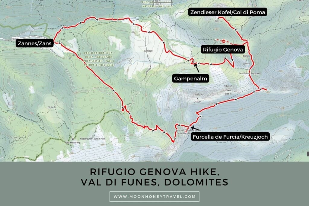
Essential Trail Info
Parking at the Zannes Trailhead | There are several paid car parks at the Zannes/Zans car park (1680 m), located at the end of the Val di Funes road. Bring cash.
Hiking Season | June – October, depending on conditions. Most huts in Val di Funes stay open until mid-October, though many close for a day during the week. We hiked this trail in early October. There was quite a bit of snow on the trail, starting at about 2000 meters.
Trail Direction | You can hike this trail in either direction. We hiked the circuit in a counter-clockwise direction, so that we didn’t have to hike uphill after eating lunch.
Difficulty | This is a moderate hiking trail. There is some light exposure, where the trail narrows between Kreuzjoch and Kreuzkofeljoch.
Trail Variations | You can detour to the Zendleser Kofel/Col di Poma (2422) summit from Ju dla Crusc/Kreuzkofeljoch above Rifugio Genova.
Where to Eat | Rifugio Genova or Malga Gampen
Responsible Hiking | This trail is located within the UNESCO World Heritage Site Puez-Odle Nature Park, a protected nature park. Wild camping, flying drones, picking flowers, and lighting fires is forbidden.
Rifugio Genova Circuit Trail Description
Zannes/Zans to Furcella de Furcia/Kreuzjoch (2 hours)

To find the Rifugio Genova trailhead, head to the Sas Rigais bar/restaurant/pension (middle parking lot) at Zannes/Zans.
Follow trail 6 in the direction of Kreuzjoch, signed 2 hours. From the very beginning, the vertical Odle/Geisler spires stun with their striking shapes and stature.
The wide gravel track continues towards these iconic peaks through spruce forest and along the Rio San Zennon/Sankt Zennon Bach stream.
After ascending for about 25-30 minutes, trail 6 intersects with a gravel road. Turn left onto the road, following signs to Tschantschenon (10 min) and Kreuzjoch (1:10 hours). Shortly thereafter, trail 6 heads right at the bend, leaving the road behind.
You’ll soon reach the Tschantschenon Alm (1928 m, private). Hike up the alpine pasture to the pasture gate. From here, there are two tracks. We took the upper left track, following the wooden pasture fence. The trail narrows and ascends more steeply now.
Soon, trail 6 crosses a gorgeous meadow dotted with larch and stone pine trees, before slowly snaking its way up to the Furcella de Furcia/Kreuzjoch saddle (2293 m).

As you gain elevation, the views of the Odle/Geisler group are wondrous. From this vantage point, these famous peaks are almost unrecognizable.
You’ll also see Resciesa Plateau and the high alpine pastures of Val di Funes like Malga Brogles and Malga Casnago/Gschnagenhardt-Alm.
Furcella de Furcia/Kreuzjoch to Rifugio Genova/Schlüterhütte (50 minutes)

From the Kreuzjoch saddle, turn left and follow trail 5 to Medalges Alm, which is also signed trail 3 to Rifugio Genova (50 minutes).
When you reach the two huts of Medalges Alm (2293 m), turn left. Trail 3 soon turns into a lovely balcony path, horizontally crossing the tussock slope of Medalges and Sobutsch. Directly ahead, you’ll see Sas dla Crusc, which looks like a beached steamship, rising above Val Badia.
The valley below is Longiarú, flanked by the Puez Group and it’s attractive peaks: Piz Duleda, Antersasc, and Crep dales Dodesc.
After 1.3 km of gentle walking, the path makes a sharp left turn and descends. The southern face of Sass de Putia/Peitlerkofel is clearly visible to the North. Before starting your descent, you can continue straight for a few meters to a viewpoint.

This downhill stretch was a bit tricky, but mostly because of the frozen snow. Hopefully, your conditions will be less wintery.
After about 20 minutes, you’ll reach a trail junction. Continue on trail 3, straight to the green-roofed Rifugio Genova (2297 m, 10 minutes).
This cozy hut dates back to 1898 and is a hospitable place for lunch. When we arrived, the hut was brimming with visitors, all eager to eat a warm South Tyrolean meal on a cold autumn day.
Rifugio Genova/Schlüterhütte to Malga Gampen/Gampenalm (30 minutes)

You can hike to Malga Gampen/Gampenalm (2062 m) on trail 33 or trail 35. We opted for trail 35 (the road) because of the snow conditions.
Simply follow either trail to the Gampen alpine pasture. This alpine pasture hut is open daily in summer and also serves South Tyrolean specialities.
Malga Gampen/Gampenalm to Zans/Zannes (50 minutes)
There are two ways to hike to Zans: trail 31A via Kaserill Alm or trail 33.
We hiked along trail 33, which we highly recommend. The fenced-in path descends across wide-open pastures, yielding more spectacular views of the Odle/Geisler group.
You’ll hike along a cobbled path before reaching the Rio Caserill/Kaserill Bach stream. Cross the bridge and continue 20 minutes along the gravel road to Zans.
Where to Stay in Val di Funes

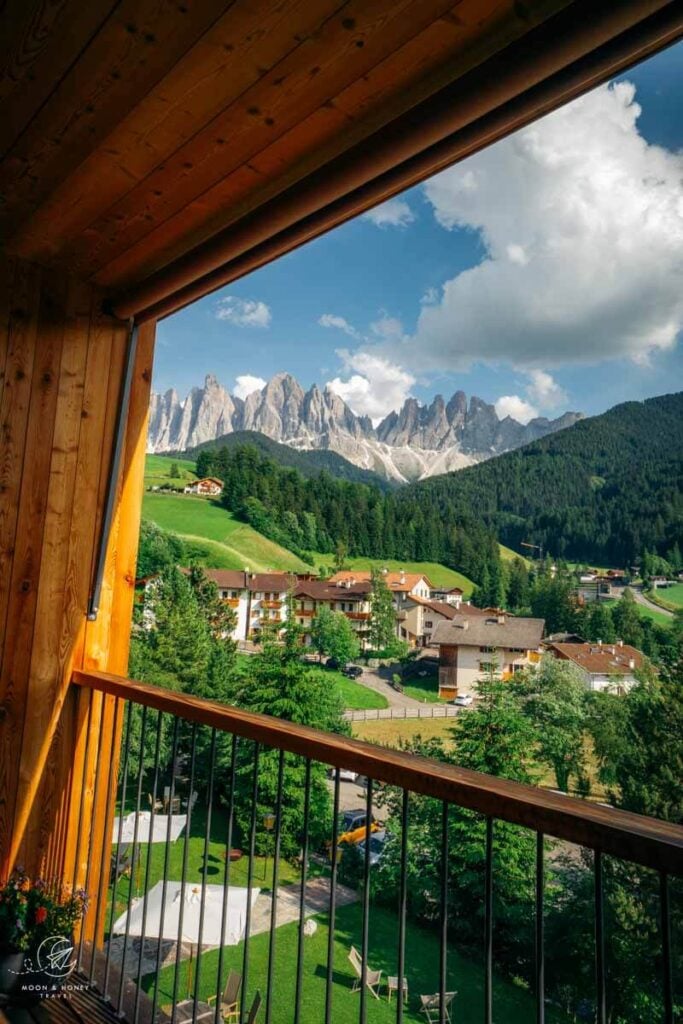
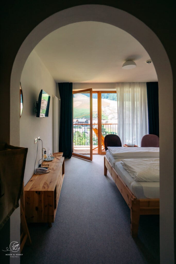
We recommend staying in the village of Santa Maddalena in Val di Funes. From this village, you can reach the Zannes/Zans car park (trailhead) by car in 10 minutes, or by bus. If you stay in Val di Funes, you’ll also have time to hike the Santa Maddalena Panorama Trail, the Adolf Munkel Trail, and our personal favorite Monte Tullen.
Budget | Appartements Pension Sonia is a no-frills, budget-friendly guesthouse in Santa Maddalena. Breakfast is included in the room rate.
Budget | Fallerhof is an active farm and a great-value apartment-style accommodation with stunning views of the Geisler Group. It’s a short walk to the Santa Maddalena Church (5 minutes) and the famous Chiesetta di San Giovanni in Ranui (15 minutes). Breakfast is available upon request.
Midrange | Hotel Fines is a welcoming, 3-star hotel in Santa Maddalena, owned by a young and enthusiastic team. Guests love the rich breakfast buffet, central location, and hotel restaurant. Definitely book half board (breakfast and dinner) here. The DolomitiMobil Card is free for all guests.
Midrange | Proihof is a happily-situated farm stay in Santa Maddalena offering charming alpine rooms and apartments as well as stellar views of the Odle/Geisler Group. Stay here for the dreaming surroundings, farm animals, and down-to-earth atmosphere.
Luxury | Hotel Tyrol Dolomites is a family-run hotel in Santa Maddalena. This is the best place to stay when you want to combine outdoor exploration with wellness and relaxation. Their wellness area encompasses a Finnish sauna, steam bath, outdoor pool, whirlpool, and a garden with sun loungers and parasols. However, the main reason to stay here is their South Tyrolean cuisine, made with locally sourced ingredients. The DolomitiMobil Card is provided. Tip: book half board and book a room with a Dolomites view (“Geisler Blick”).
Look for accommodation in Val di Funes.
Dolomites Hiking Guides
Day Hikes:
- Best Day Hikes in the Dolomites
- Easy Walks in the Dolomites
- Val Gardena Hikes
- Cortina d’Ampezzo Hikes
- Sexten Dolomites Hikes
Travel Guides:
- Dolomites Travel Guide
- Places to Visit in the Dolomites
- Things to Do in the Dolomites
- How to Get to the Dolomites
- How to Visit the Dolomites Without a Car
- Best Time to Visit the Dolomites
Pin this Image for Future Trip Planning!
Stay Connected:
Connect with us on Pinterest.
Follow us on Instagram.
Like us on Facebook.
Support Us:
If you love reading my content, you can send me a direct donation.



Could you combine this with the Adolf Munkal trail into one ~20km loop hike? If so which would you recommend doing first? Thank you!
Hi Sophie,
Yes, that’s a great idea. The combined hike should be no more than 15.6 km with 890 meters of elevation gain/loss.
All the best,
Sabrina