Cadini di Misurina is a spectacular mountain group in the Sexten Dolomites, distinguished by its sharp ridges, slender spires, and jagged pinnacles that create a skyline worthy of a high-fantasy epic.
The name “Cadini” refers to the many high valleys and cirques, called “cadin” or “ciadin,” that dissect the massive towers of the Cadini Group. “Misurina” refers to Lago di Misurina, the beautiful lake that lies at the southwestern foot of the Cadini di Misurina Mountains.
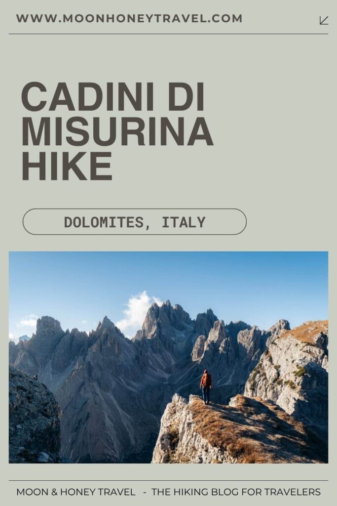
Though these peaks are striking from multiple angles, there’s one vantage point that upstages all others. Nicknamed the Cadini di Misurina Viewpoint and sometimes referred to as the Towers of Mordor, this lookout point brings you face-to-face with the northern side of the Cadini di Misurina Group.
Kati and I hiked to Cadini di Misurina from Rifugio Auronzo (the fastest and easiest approach) and then followed the challenging Sentiero Alberto Bonacossa Trail through the range to Rifugio Fratelli Fonda Savio. We descended to Lake Antorno and then completed the circuit back to Rifugio Auronzo.
Here are all the ways you can hike to Cadini di Misurina.
- Other Names: Ciadìs de Meśorìna in Ladin
- Camera Gear: I mounted the Tamron 17-70mm 2.8 Di III-A VC RXD on Sony Alpha a6400. Read my guide to Camera Gear for Hiking.
- When to Hike: Late June – Mid-October, depending on snow conditions
- Weather Forecast and Webcam: 3BMeteo Weather Misurina
- Where to Stay near Cadini di Misurina: Quinz – Locanda Al Lago (budget), Chalet Lago Antorno (midrange), Hotel Miralago (midrange), or Chalet Alpenrose (luxury)
- Recommended Trail Map: Tabacco 010: Dolomiti di Sesto 1:25.000
- Recommended itineraries: 5 Day Dolomites Itinerary, 7 Day Dolomites Road Trip, or Dolomites Itinerary 10-14 days
Cadini di Misurina Hiking Map
CADINI ASCENT ROUTES
Rifugio Auronzo Route
Lago Antorno Route
Sentiero Bonacossa Northern Circuit
Sentiero Bonacossa
Quick Summary of the Cadini di Misurina Viewpoint Hikes
There are four possible routes to the Cadini di Misurina Viewpoint.
The fastest way to get to the Cadini Viewpoint is by driving, or taking the bus, to Rifugio Auronzo via the Rifugio Auronzo toll road (pre-booking mandatory), open between late May/early June and late October/early November. From the Rifugio Auronzo car park, it’s a 35-minute walk to the famous Cadini viewpoint. This short out-and-back hike can easily be combined with the Tre Cime di Lavaredo Circuit trail in a single day.
Alternatively, you can skip the expensive toll road, and hike to the Cadini di Misurina viewpoint from Lago d’Antorno, located just south of the toll road gate. This is the best option for travelers who didn’t or don’t want to pre-book the toll road access.
Experienced hikers can also approach the Cadini di Misurina viewpoint from the south along the challenging Sentiero Alberto Bonacossa Trail, starting at Rifugio Col de Varda or Lake Antorno. This is the most exciting option for confident high-alpine hikers.
1. Rifugio Auronzo – Cadini di Misurina Hike (Easy)
Trailhead | Rifugio Auronzo | Google Maps
Distance | 3.9 km out-and-back
Time Needed | 1 – 1:30 hours
Elevation Gain/Loss | 144 meters
Minimum Elevation | 2256 meters
Maximum Elevation | 2334 meters
Trail | 117
Get to Rifugio Auronzo
Rifugio Auronzo (2333 m) is a high-alpine refuge located at the southern foot of Tre Cime di Lavaredo along the Tre Cime di Lavaredo Circuit Trail. In summer and early fall, you can drive all the way up to the hut via the Auronzo toll road, so long as you have pre-booked your parking.
There are also bus connections to the Auronzo hut from Lake Misurina, Cortina d’Ampezzo, and Dobbiaco/Toblach. If you’re staying in South Tyrol (e.g. Dobbiaco, San Candido, Sesto), use the suedtirolmobil.info journey planner to look up bus schedules.
Toll Road Seasonal Opening Times | Late May/Early June – Late October/Early November, depending on weather and snow conditions.
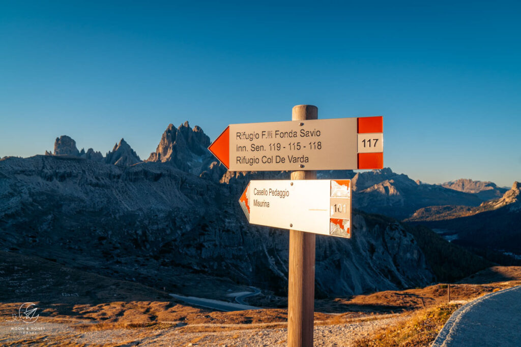
Locate Trail 117
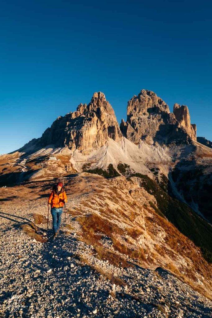
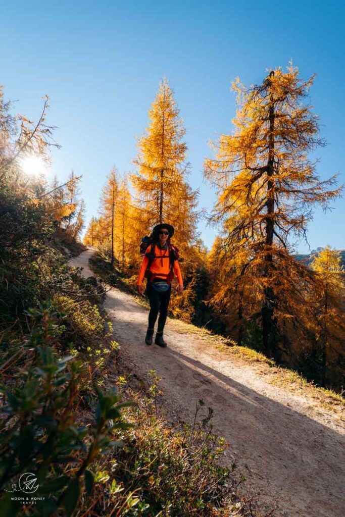
From the Rifugio Auronzo car park, look south in the opposite direction of the Three Peaks. You can already see the jagged Cadini di Misurina spires as well as Monte de le Cianpedele/Monte Campedelle, a mountain which looks insignificant by comparison. That’s where you’re headed.
Trail 117 (aka Sentiero Bonacossa Trail) will steer you directly to the Cadini di Misurina Viewpoint.
The best way to locate trail 117 is by heading to Rifugio Auronzo. From the mountain hut’s outdoor terrace, walk down the paved steps along the road. Directly at the road, there’s a trail sign guiding you south in the direction of Rifugio Fratelli Fonda Savio (Trail 117).
This clear path steers you away from the mammothTre Cime di Lavaredo and towards Monte de le Cianpedele/Monte Campedelle (2346 m) and the razor-sharp Cadini peaks.
Follow Trail 117 to Forcella Longeres
The path initially descends for about 10 minutes to the Forcella Longères saddle. Ignore the path that branches off to the right in the direction of Casello, Lago Antorno, and trail 101.
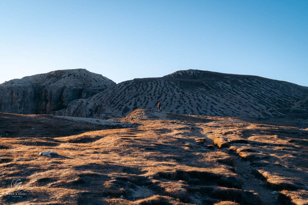
Continue straight along trail 117, making a quick counter-ascent across the high plateau of Monte de le Cianpedele/Monte Campedelle.
To the east (looking left), you’ll see the deep Vallone di Lavaredo – Valle Marzon valleys and several prominent peaks of the Sexten Dolomites.
Looking behind you, the views of the Three Peaks get better and better.
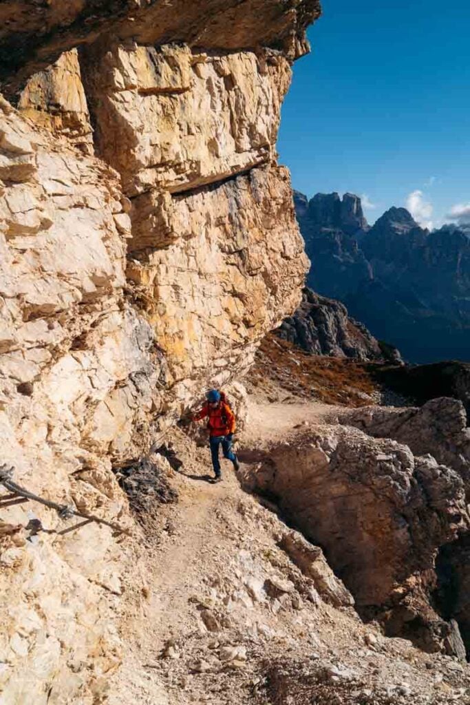
Trail 117 Junction 1 – Bear Right
After ascending for a few minutes, the path divides. Ignore the left trail. It’s dangerous, because the ledge path is eroding and in poor condition.
We took this precarious path, not knowing that it’s actually fenced off on the other side.
Bear right instead, following the official trail, which is waymarked with mini poles.
Trail 117 Junction 2 – Bear Right or Left
When the trail divides again, about 10 minutes later, you can now follow the well-established left footpath, which skirts the summit of Monte de le Cianpedele/Monte Campedelle. This ledge path is very narrow, but stable.
Note: you will not see this trail delineated on most paper trail maps.
Alternatively, you can continue on the right trail to the viewpoint. This is the better option if you have any fear of heights, or if the trail is wet and slippery. This trail is marked on all paper trail maps.
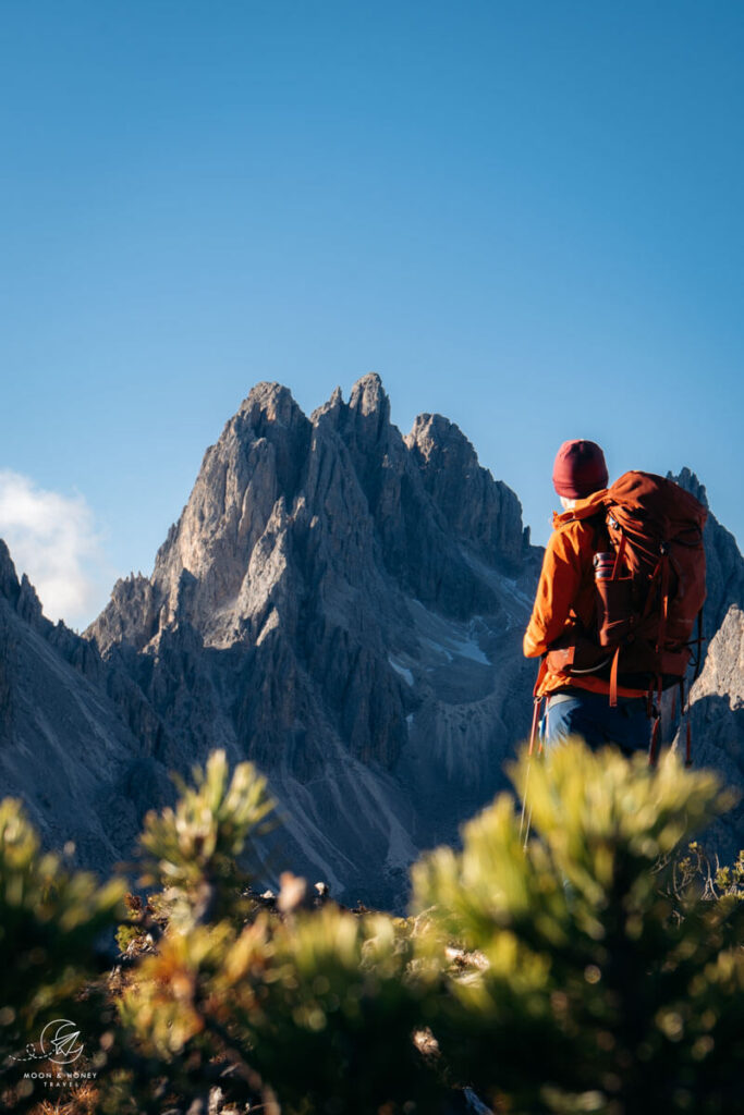
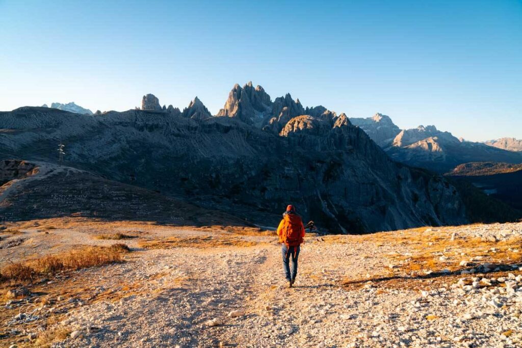
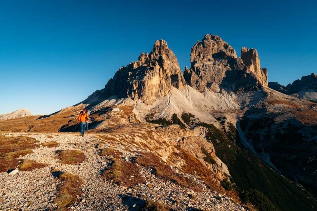
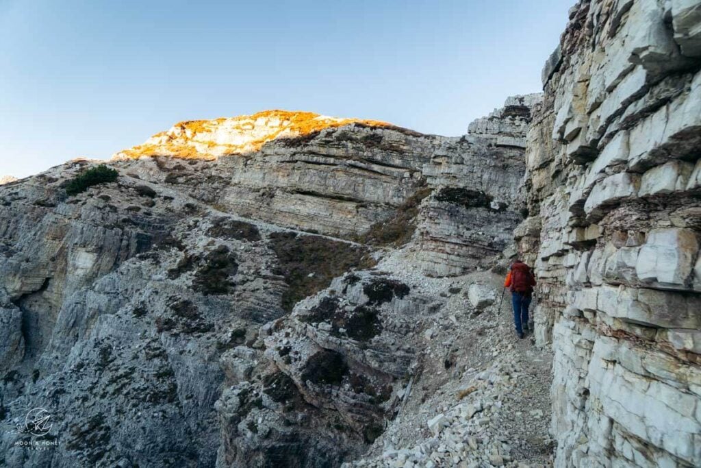
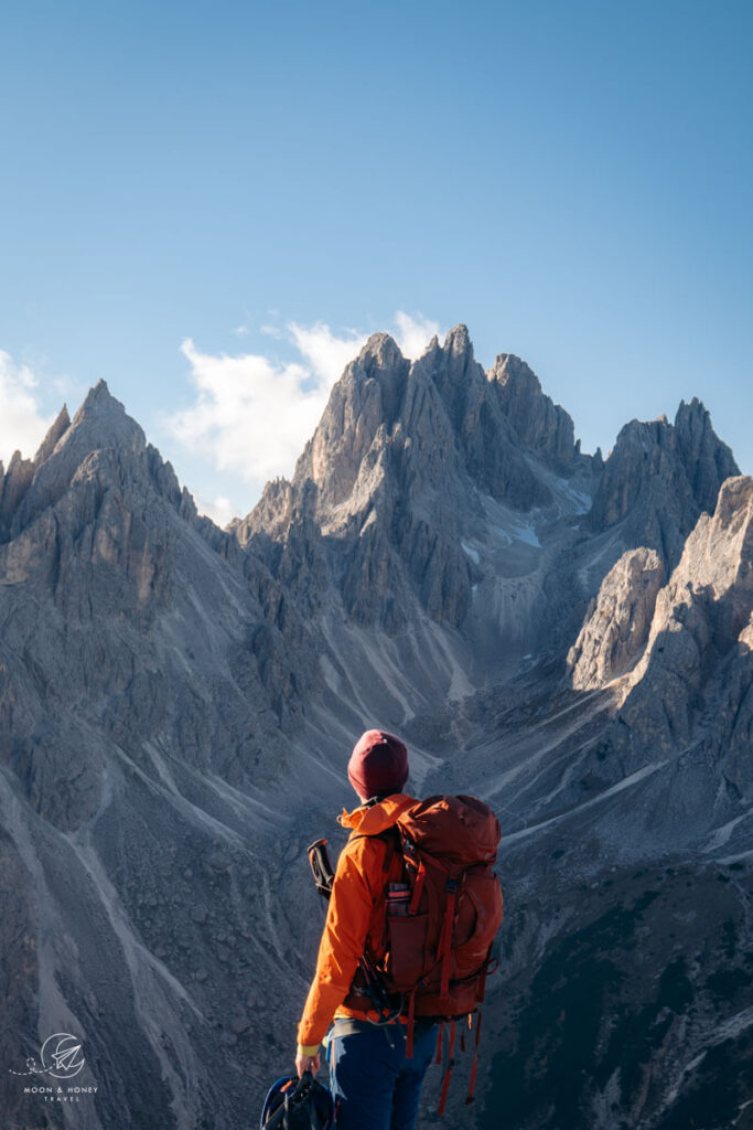
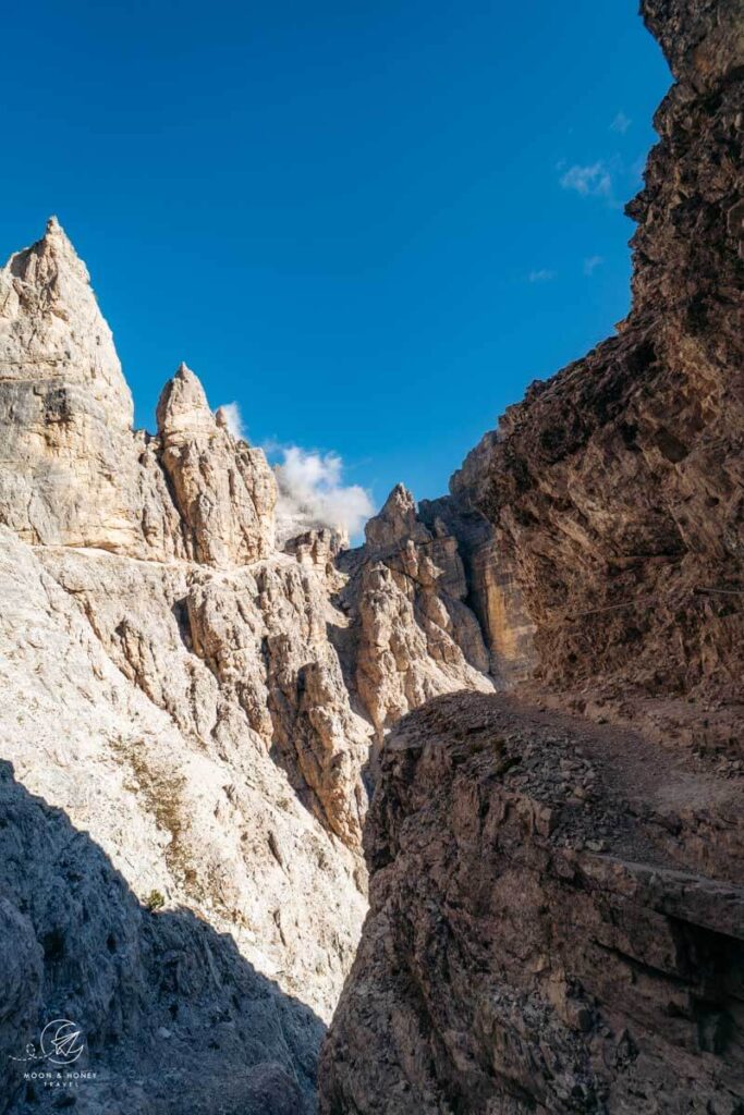
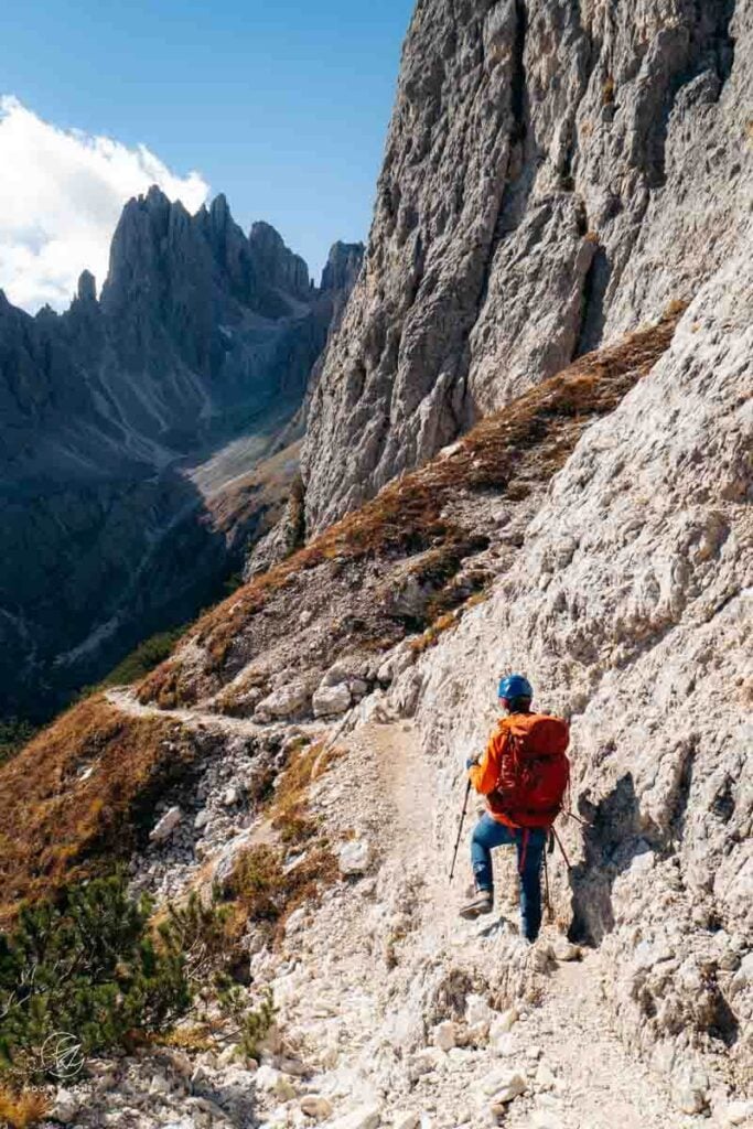
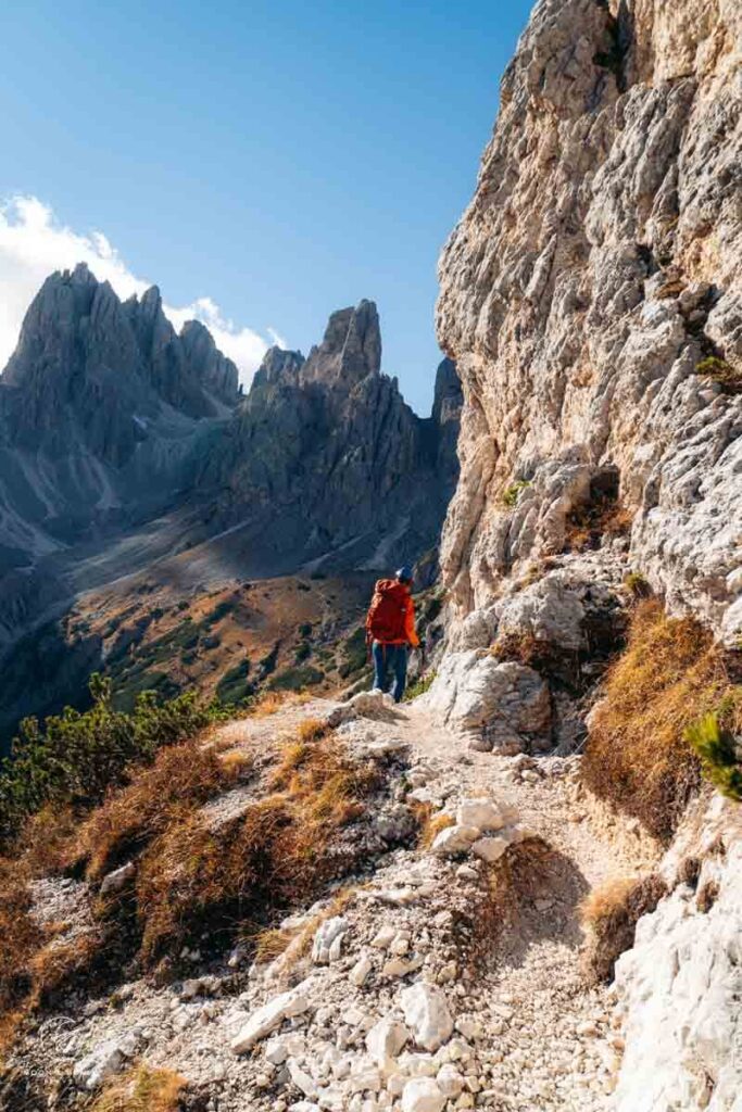
We opted for the left path. Following the left path, the views of the Cadini di Misurina mountains mesmerize and it’s all too easy to lose track of time. Rising before you is a dramatic procession of razor-sharp peaks: Cimon di Croda Lissa, Cima Cadin Nord Est, Cima Cadini di San Lucano, Cima Eotvos, Cima Cadini della Neve, and Cima Cadini di Misurina.
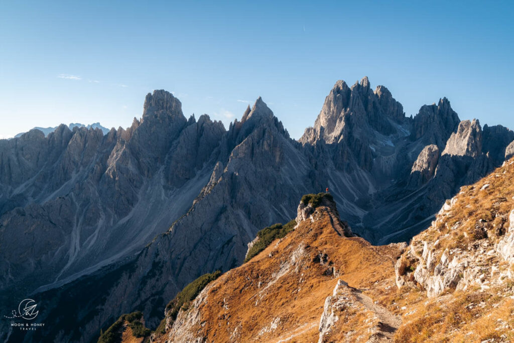
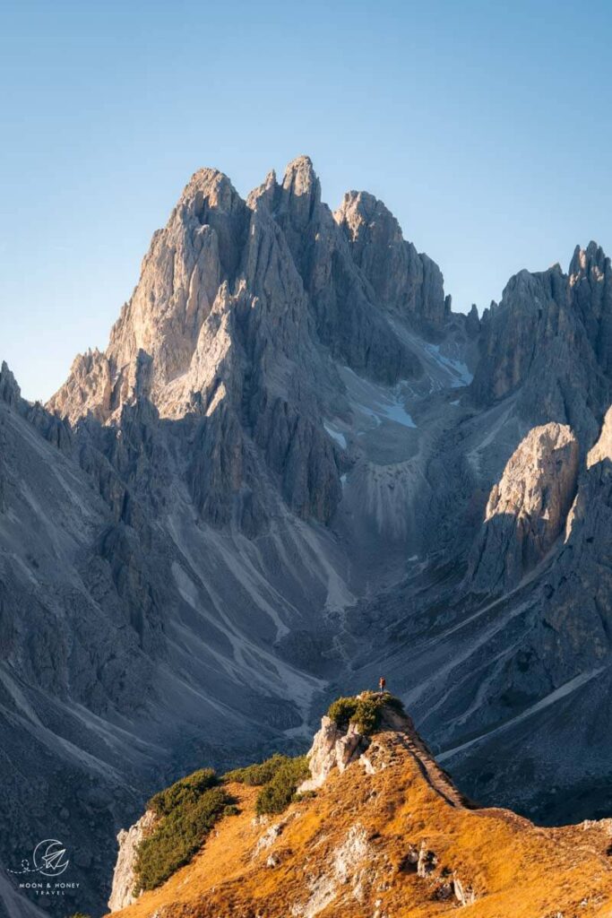
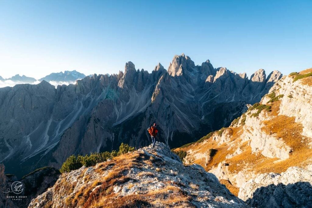
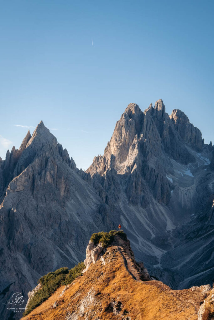
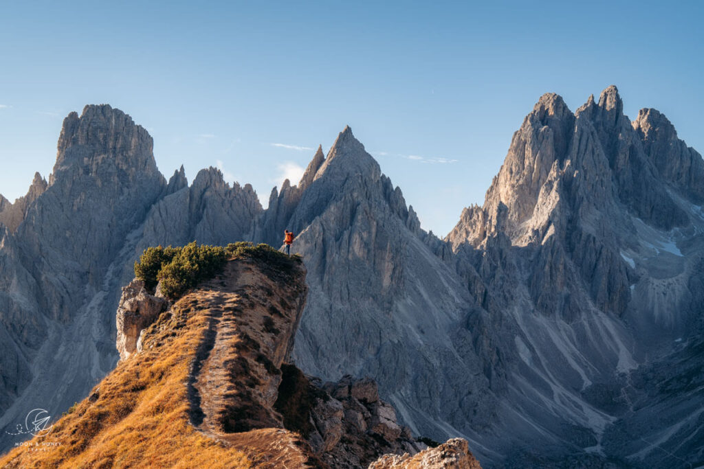
Soon, you’ll see the famous Cadini di Misurina viewpoint, which is a grassy ridge sloping upwards and projecting triumphantly towards the Cadini pinnacles. It looks like a small ski jump.
Trail 117 continues steadily towards this impressive viewpoint, crowned by dwarf pine. From this perspective, the northern pinnacles look like a stone forest of giant blades.
The Cadini di Misurina “ski jump” viewpoint is a popular photo motif, which means you’ll likely encounter a line-up of tripods and a handful of drones (which are technically not allowed) during your visit, especially around sunset. Luckily, there is more than enough room for everyone and multiple photo spots to explore.
In addition to the celebrated Cadini photo spot (which we’re calling the “ski jump”), there are many amazing photo opportunities along the approaching trail and atop the plateau.
Cadini di Misurina Viewpoints
Approximately 150 meters before you reach the obvious viewpoint, the left and right paths merge and then split once again.
The lower track follows the ledge and leads to the celebrated Cadini di Misurina viewpoint. The narrow path to the “ski jump” viewpoint branches off to the left of the main trail 117. Only hike up there in dry conditions.
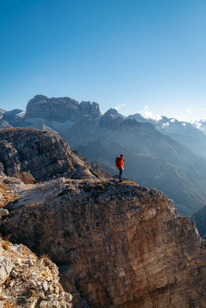
The upper track leads to a panoramic plateau with several other great Cadini di Misurina photo spots, a worthy detour. From this higher-elevation vantage point, there are more excellent views of Cadini di Misurina as well as Tre Cime di Lavaredo (to the south), Val Marzon and Croda dei Toni/Zwölferkofel (to the east), the Cristallo Group, Croda Rossa d’Ampezzo/Hohe Gaisl, and Picco di Vallandro/Dürrenstein (to the west).
Return to Rifugio Auronzo
This marks the end of the Cadini viewpoint hike. Retrace your steps back to Rifugio Auronzo.
Or, Extend Your Hike to Rifugio Fonda Savio
From afar, the Cadini mountains seem impenetrable. However, these seemingly intimidating mountains are furrowed with many exciting hiking trails.
What most people don’t realize is that the Cadini Viewpoint is situated along the Sentiero Bonacossa Trail, a thrilling route which traverses the Northern and Western Cadini Mountains. This famous protected route connects Rifugio Auronzo with Rifugio Fonda Savio and Rifugio Col de Varda.
If you’re an experienced alpine hiker, you can continue south along trail 117 to Rifugio Fonda Savio. That’s what we did and it was unforgettable.
2. Lake Antorno – Cadini di Misurina Hike (Moderate)
Trailhead | Lake Antorno Car Park | Google Maps
Distance | 9.7 km out-and-back
Time Needed | 3:40 hours
Elevation Gain/Loss | 485 meters
Difficulty | Moderate
Minimum Elevation | 1856 meters
Maximum Elevation: 2341 meters
Trails | 101 and 117
Step 1: Get to Lago d’Antorno | Lake Antorno (1890 m) is located along the Tre Cime di Lavaredo Panoramic Road, north of Lake Misurina, and just 650 meters south of the toll gate. There’s a free car park next to Chalet Lago Antorno.
Step 2: Walk North to the Toll Gate | Follow the trail along Lago d’Antorno. At the northern end of the lake, leave the lake path and continue north towards Tre Cime di Lavaredo. Parallel to the main road, follow a soft forest path to the Misurina Casello signed intersection, which is just below the Rifugio Auronzo/Tre Cime toll gate.
Step 3: Follow Trail 101 in the direction of Rifugio Auronzo | At the intersection, head right, away from the road, and follow trail 101 in the direction of Rifugio Auronzo. After about 10 minutes, you’ll reach the Rio di Rinbianco signed intersection. Continue left over the creek in the direction of Rifugio Auronzo. After passing a large meadow, ringed by larch, the trail begins to gradually ascend.
Trail 101 progresses uphill through a larch forest on an enjoyable, undulating path. After you clear the foreset line, the path levels out and cuts across the rocky western slopes of Col de le Bisse. The trail descends a few meters to the valley floor of Val del Ciadin de Longares, where there’s a trail juncture. Here, you can hike to Rifugio Auronzo first (following trail 101) or take the more direct trail to the Cadini di Misurina Viewpoint via Forcella Longeres saddle.
Step 4: Ascend to Forcella Longeres | Head right in the direction of Forcella Longeres and trail 117. It’s a 1 km (210 meter elevation gain) ascent to the Longeres saddle. The path climbs up the Ciadin de Longeres Valley/Cirque and crests at the Forcella Longeres saddle.
Step 5: Follow Trail 117 to the Cadini di Misurina Viewpoints | From the saddle, continue right (south) and follow trail 117 to the Cadini Viewpoint (30 minutes).
Step 6: Complete Hike | To complete this trail, you can either return to Lake Antorno along the same trail, or detour to Rifugio Auronzo (for lunch) and then descend to the lake along trail 101. Note: this trail crosses the toll road twice.
3. Sentiero Bonacossa Trail (Difficult)
Starting Point | Col de Varda chairlift car park at Lake Misurina | Google Maps
Trailhead | Rifugio Col de Varda, easily reached with the Misurina-Col de Varda chairlift
Ending Point | Rifugio Auronzo
Distance | 7.2 km point-to-point
Time Needed | 4 hours
Elevation Gain | 1020 meters
Elevation Loss | 816 meters
Minimum Elevation | 2108 meters
Maximum Elevation | 2495 meters
Trail | 117
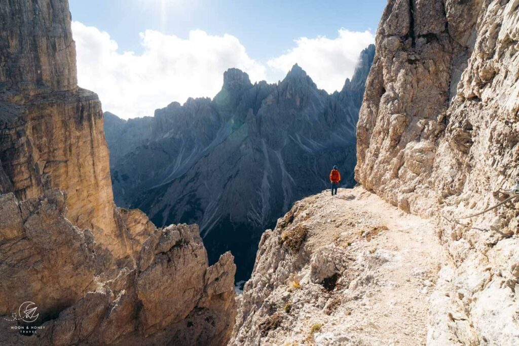
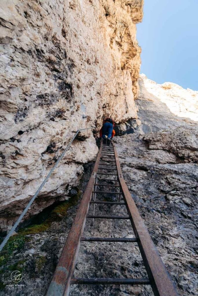
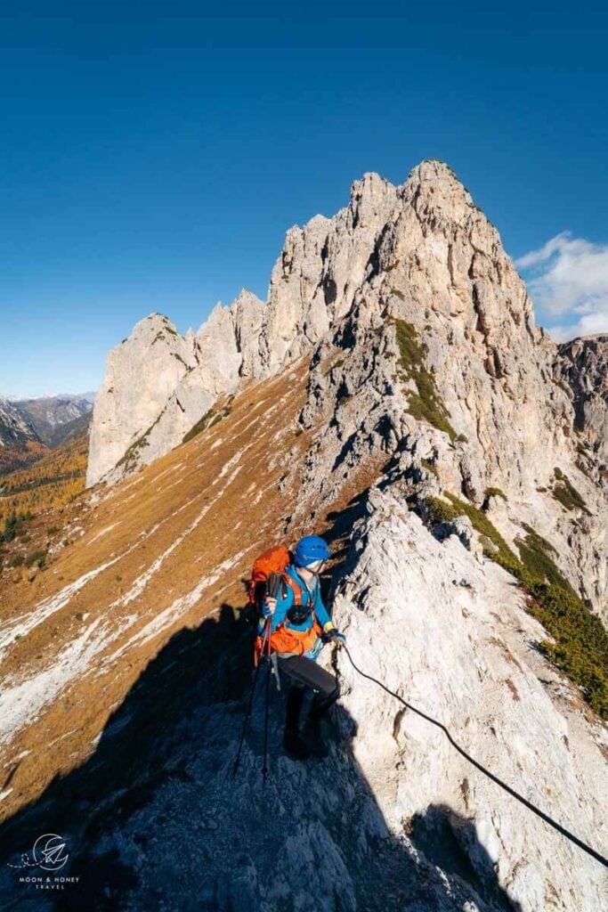
The most exciting, albeit strenuous, approach to the Cadini Viewpoint is from the south, along the Sentiero Bonacossa Trail.
This route is something between an easy via ferrata and a difficult hiking trail. All exposed sections are secured with cables. Though a full via ferrata kit isn’t necessary, we highly recommend wearing a climbing helmet and climbing gloves.
The path bisects the range, starting at Rifugio Col de Varda (2106 m), which is accessible by chairlift from Lake Misurina.
The trail leads north to Rifugio Fonda Savio (2367 m) and then eventually up to Rifugio Auronzo.
You can hike the full Sentiero Bonacossa trail from Rifugio Col de Varda to Rifugio Auronzo and then return to Lake Misurina by bus, or hike the Sentiero Bonacossa North Route circuit, as described below.
4. Sentiero Bonacossa North Trail Circuit – What We Did (Difficult)
Trailhead | Rifugio Auronzo or Lago Antorno
Distance | 12.5 km circuit
Time Needed | 6 hours
Elevation Gain/Loss | 869 meters
Minimum Elevation | 1838 meters
Maximum Elevation | 2346 meters
Trails | 117, 115, 101
It’s possible to start the Sentiero Bonacossa North Circuit at either Rifugio Auronzo or Lago d’Antorno (best option).
We started this route at Rifugio Auronzo and hiked the Sentiero Bonacossa north-to-south, because we wanted to return to the Cadini di Misurina viewpoint for sunset, after completing the hike.
Unless you want to experience sunset at the viewpoint, definitely start the hike at Lago d’Antorno. The main reason is that it’s safer and easier to hike the Sentiero Bonacossa trail south-to-north. It’s also the more practical approach, since you won’t have to pre-book the Auronzo toll road.
Starting at the Auronzo hut, we followed Trail 117 to the Cadini di Misurina Viewpoint (as described earlier in this post) and then continue along 117 through the Cadini Mountains to Rifugio Fonda Savio. From this hut, we followed trail 115 down to Lake Antorno and then hiked up trail 101 to Rifugio Auronzo.
I’ve described the path in great detail in my Sentiero Bonacossa North Trail Guide.
Cadini di Misurina FAQ
When Can You Hike to Cadini di Misurina?
The toll road to Rifugio Auronzo is usually open from June until October. The dates change each year, depending on the snow conditions.
We recommend hiking to the Cadini di Misurina viewpoint in September, or October. The weather is generally more stable in autumn.
If you’re visiting the Dolomites in high summer (July and August), expect more people. June can also be promising, but it’s likely that there’s still a lot of snow in the Sexten Dolomites.
Where is Cadini di Misurina?
The Cadini di Misurina mountains are located in the municipality of Auronzo di Cadore in the Italian province of Belluno in Veneto.
They form the southernmost mountain group of the Sesto/Sexten Dolomites, a sub-range of the Italian Dolomites, which extend into the Italian Province of South Tyrol. The Northern (South Tyrolean) Sexten Dolomites are protected within the UNESCO World Heritage Site of Tre Cime Nature Park.
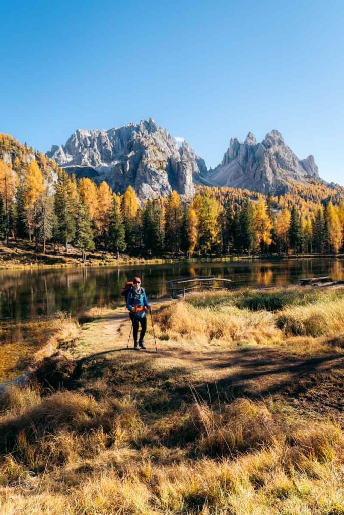
Cadini di Misurina is bounded by the Misurina Lake to the west, the Lavaredo Group to the north, the Val Marzon and Vallone di Lavaredo valleys to the East, and the Ansiei valley to the South.
Neighboring ranges include the Cristallo-Popena Group (east), Sorapiss Group (south), and Lavaredo Group (north).
The highest peak is Cima Cadin of San Lucano (2839 m).
Where to Stay
Lake Antorno and Lake Misurina

If you want to deeply explore the southern Sesto/Sexten Dolomites, we recommend staying near Lake Antorno or Lake Misurina. From Lago d’Antorno, it’s a mere 10 minute drive to Rifugio Auronzo.
Midrange | Albergo Chalet Lago Antorno is situated along the Tre Cime di Lavaredo panoramic road, directly across from Lake Antorno. With its unbeatable location, you can embark on a variety of hikes directly from the hotel’s doorstep: Rifugio Fonda Savio, Rifugio Auronzo, Monte Piana. As a guest, you’ll love the views of the Cadini di Misurina peaks, the cozy rooms, and the on-site à la carte restaurant. Breakfast is included.
4-star Luxury | Chalet Alpenrose offers sparkling new rooms and apartments at Lake Misurina. There is a minimum stay requirement of at least 3 nights.
Look for accommodation near Lake Misurina.
Cortina d’Ampezzo


Ringed by the Ampezzo Dolomites, Cortina d’Ampezzo boasts a central and stunning location in the Ampezzo Valley in Veneto. You can stay here for a few days or for several weeks and never run out of things to see and do. Read Where to Stay in Cortina d’Ampezzo for a comprehensive guide to the best areas to stay in and around Cortina.
Budget | Hotel Meuble Oasi is a guesthouse set in the town center of Cortina d’Ampezzo, walking distance to the pedestrian zone and bus station. Book this 2-star hotel for the unbeatable price, location, spotless ooms, and on-site parking.
Midrange | Baita Fraina is a charming B&B with six rooms with balconies, 3km from Cortina’s town center (5 minute drive). This guesthouse is also home to a Michelin recommended à la carte restaurant, which serves regional cuisine. Stay here for the mountain views, the affordability, and the food.
Midrange | Hotel Villa Alpina is a centrally-located 3-star-superior hotel housed in a historic villa. Rooms are comfortable and feature parquet floors and alpine furnishings. The room rate includes breakfast and outdoor parking.
Midrange | Ambra Cortina Luxury&Fashion Hotel is a lovely boutique hotel with 24 thematic rooms and a bar in the very center of Cortina. Guests are treated to free on-site parking and an excellent breakfast.
Top Choice – Luxury | Camina Suite & Spa is a 4-star boutique hotel, 1 km north of Cortina’ town center. This intimate hotel with 12 rooms offers alpine-style suites with comfy beds and ample closet space. Rooms are equipped with nespresso machines, air-conditioning, and soundproofing. We loved the high-quality breakfast and complimentary spa (3 saunas, relaxation zone, and showers). Read our Camina Suite & Spa hotel review.

Top Choice – Luxury | HOTEL de LËN is a fresh-faced luxury hotel in Cortina d’Ampezzo’s town center. Interiors blend natural and sustainable materials with fine furnishings to create a relaxing, yet refined atmosphere. The hotel restaurant showcases local Ampezzo flavors in unique and exciting ways. We loved the charming, enthusiastic staff, the rooftop spa (1 complimentary hour), and communal areas (living room, cocktail bar, and restaurant). Breakfast is included in the room rate. Parking is off-site and an extra charge. Read our Hotel de Len review.
Luxury | Grand Hotel Savoia Cortina d’Ampezzo, A Radisson Collection Hotel is a top-rated, 5-star hotel in the center of Cortina d’Ampezzo. Although housed in a historic building, the entire interior has been renovated. Rooms are delightfully modern. Stay here for the superb on-site restaurant, impeccable staff and concierge, top-notch facilities (spa, indoor pool, bar, and lobby area).
More Dolomites Hiking Trails
Ampezzo Dolomites:
- Cortina d’Ampezzo Hiking Guide
- Croda da Lago Circuit
- Tofana di Roses Circuit
- Passo Giau to Mondeval
- Lago Federa
- Lago delle Baste
- Rifugio Nuvolau and Cinque Torri
- Lago di Sorapis Hike
Sesto / Sexten Dolomites:
Braies / Prags Dolomites:

Pin this Image for Future Trip Planning!
Stay Connected:
Connect with us on Pinterest.
Follow us on Instagram.
Like us on Facebook.
Support Us:
If you love reading our content, you can buy us a coffee via Ko-Fi.


Many thanks for the detailed explanation. It will be super helpful.
If we have to choose just one hike, which one do you recommend?
Tre Cime loop or Cadini di Misurina?
We are not very fit and I don’t think we can do them both in one day.
Hi Brian,
I would hike the Tre Cime Circuit, though it’s significantly longer than the Cadini viewpoint hike. You’ll see the Cadini di Misurina mountains from the Tre Cime loop trail.
-Sabrina
We will be headed to the Dolomites at the end of May/early June. We will primarily be hiking in Val di Funes and Val Gardena, but are considering a day trip to either Prato Piazza or this area. If the toll road is open, would this hike be manageable at that time of year? I noticed that you specifically state it’s best to hike starting late June.
Hi Erika,
I recommend reaching out to the tourist office in Sexten. They will know best about current conditions.
Safe travels,
Sabrina
Hi Sabrina,
Thank you so much for this detailed blog post. On paper, it seems possible to hike from Lago Antorno to the Cadini di Misurina viewpoints via Forcella di Rinbianco, i.e. leave the green path and follow the right trail at the Rio di Rinbianco intersection and join the orange path at Forcella di Rinbianco. Do you know if this route would save any time compared with hiking via Forcella Longeres and down to the viewpoints? Is the portion of trail between the green and orange paths and between Forcella di Rinbianco and the viewpoints very difficult?
Kind regards,
Corinne
Hi Corinne,
The fastest and easiest way to hike to the Cadini Viewpoint from Lake Antorno is via Forcella Longeres. The section between Forcella Rimbianco and the Cadini Viewpoint is very beautiful, but also very difficult – it will not save you time.
Kindly,
Sabrina
Thank you so much for your answer, Sabrina.