The Alta Via 1 is a long-distance hiking trail in the Dolomites in Northern Italy, starting at Lago di Braies (Pragser Wildsee) in South Tyrol and ending at the La Pissa bus stop near Belluno.
This is a very approachable multi-day hike, perfect for people getting acquainted with long-distance trekking and hut to hut hiking in the Dolomites. Since it’s the easiest of the Alta Vie, Dolomites high routes, it’s also perfectly suitable for solo hiking. Read about my AV1 solo hiking experience.
As wild camping is forbidden along the route, you’ll stay in staffed Rifugios (Rifugi in Italian, Hütten in German) along the way. These mountain shelters range from rustic to luxurious. No matter where you stay the night, you can expect tasty food, excellent company, and a comfortable place to sleep.
Some of our fondest memories of hiking the Alta Via 1 were the conversations and laughs we shared with fellow hikers inside the rifugi.
In this Alta Via 1 hiking guide, you’ll learn exactly how and when you should book rifugios, what itineraries to consider, how to get to the trailhead, and more.
If you want to hike the Alta Via 1 in 2027, I recommend booking now!
Alta Via 1 Hiking Trail Facts
Starting Point | Lago di Braies (Pragser Wildsee) in South Tyrol
Ending Point | La Pissa Bus Stop, a 20-minute bus ride to Belluno
Total Distance | 120 km point-to-point
Days Needed | 10 days. Shorter routes are possible.
Difficulty | Easy-Moderate
Permit Needed | None
Accommodation | Rifugios (mountain huts)
We wrote this Alta Via 1 trekking guide based on our personal experience. Keep in mind that things can change over time: trail difficulty, accessibility, and routing (due to rock falls) and hut management (reservation system, hospitality, payment, food quality, etc…). Please do your due diligence before tackling this route.

- When to Hike: mid-June to late September.
- Where to Stay: Mountain Huts only. Camping is strictly prohibited.
- How to Book the Alta Via 1: Independently, or with a self-guided hiking tour company. Read my guide to booking Alta Via 1 Rifugios.
- Solo Hiking: Solo Hiking the Alta Via 1
- What to Pack: Cash, sleeping bag liner (e.g. Sea to Summit liner). Read our Hut to Hut Hiking Packing List.
- Hiking Guidebook: Trekking the Dolomites AV1
- Tips for Hut Hiking in the Dolomites: Read Hut to Hut Hiking in the Italian Dolomites
Alta Via 1 Hiking Map
STAGES
Stage 1
Stage 2
Stage 3
Stage 4
Stage 5
Stage 6
Stage 7
Stage 8
Stage 9
Stage 10
Alta Via 1 Itinerary
10-Day Alta Via 1 Hiking Route
The 120-km-long Alta Via 1 (Dolomiten Höhenweg) is hiked north to south and generally broken up into the following 10 stages.
Stage 1 | Lago di Braies – Rifugio Biella (or better Rifugio Sennes)
Stage 2 | Rifugio Biella – Rifugio Fanes (or Rifugio Lavarella)
Stage 3 | Rifugio Fanes – Rifugio Lagazuoi
Stage 4 | Rifugio Lagazuoi – Rifugio Nuvolau (or better Rifugio Averau)
Stage 5 | Rifugio Nuvolau – Rifugio Città di Fiume
Stage 6 | Città di Fiume – Rifugio A. Sonino Al Coldai
Stage 7 | Rifugio A. Sonino Al Coldai – Rifugio Vazzoler
Stage 8 | Rifugio Vazzoler – Rifugio Carestiato (or better Passo Duran)
Stage 9 | Rifugio Carestiato (or Passo Duran) – Rifugio Pramperet (or better Rifugio Pian de Fontana)
Stage 10 | Rifugio Pramperet (or Rifugio Pian de Fontana) to La Pissa Bus Stop – Bus to Belluno
How to Book | You can book the Alta Via 1 yourself, however you must start the process early (10 months in advance). If you need support, we recommend booking both self-guided and guided treks with Alps-based Adventure Base. Our readers get a special perk if they fill out this inquiry form or use the code MOONANDHONEY at checkout.
Alta Via 1 Shorter Itineraries
Hikers who have limited time often only hike a section of the Alta Via 1, either the northern half from Lake Braies to Cortina d’Ampezzo, or the southern half from Passo Giau (near Cortina) to the La Pissa bus stop.
If you’re trying to decide between the two sections, read my guide to Alta Via 1 North versus South. Each section has its pros and cons.
North Route
- Stage 1 | Lago di Braies – Rifugio Sennes
- Stage 2 | Rifugio Biella – Rifugio Fanes or Rifugio Lavarella
- Stage 3 | Rifugio Fanes – Rifugio Lagazuoi
- Stage 4 | Rifugio Lagazuoi – Rifugio Averau
- Stage 5 |Rifugio Averau – Paso Giau – Mondeval Plateau – Forcella Ambrizolla – Lago Federa – Optional Overnight in Rifugio Croda da Lago – Cortina d’Ampezzo. Read Where to Stay in Cortina d’Ampezzo.
Self-Guided | See this 4-Day Alta Via 1 North Trek
South Route
- Stage 1 | Passo Giau – Rifugio Passo Staulanza
- Stage 2 | Rifugio Passo Staulanza – Rifugio Vazzoler
- Stage 3 | Rifugio Vazzoler – Passo Duran
- Stage 4 | Passo Duran – Rifugio Pian de Fontana
- Stage 5 | Rifugio Pian de Fontana – La Pissa Bus Stop
Self-Guided | See this 5-Day Alta Via 1 South Trek

Alta Via 1 Difficulty
Moderate.
From a technical perspective, the AV1 is relatively easy, as it mostly follows well-graded trails with no exposure. However, the terrain is rugged and uneven, with plenty of scree and loose rock, as is typical of limestone mountain ranges.
The most challenging sections of the trail come towards the end of the route, between Rifugio Vazzoler and Rifugio Carestiato (stage 8), and between Rifugio Pramperet and Rifugio Fontana (stage 10). Here, you can expect more boulder crossings, exposed sections, and even some karst steps.
Another factor that will affect the difficulty of your AV1 hike is the pace of your itinerary and the number of stages you choose to divide the route into. I met hikers who were completing the entire route in just seven days. A 7-stage route is considerably more demanding than spreading the hike over 10-11 days.
Weather will also impact the difficulty of your trail. Kati and I barely made it to Rifugio Lagazuoi, because we got lost in a snow blizzard. YES, a SNOW BLIZZARD. I wrote about it on Instagram. The lesson we learned is: if it starts snowing, stop gaining elevation.
While the trail is easy-to-follow, it’s not always obvious. The Alta Via 1 waymark ( “1” inside a triangle) isn’t consistently marked throughout the trekking route. Don’t rely on Alta Via 1 signage alone to guide you in the right direction. We met other hikers who got lost, or took accidental round-about routes to the next rifugio.
I recommend using the Mapy.cz app (download the Northeastern Italy map for offline use) in combination with a paper trail map, which you can purchase in the huts, for navigation.
When Can You Hike the Alta Via 1
July, August, or early-mid September.
You must time your trek with the opening times of the rifugios. The Alta Via 1 huts typically open around mid-June and stay open until late-September. If you hike the Alta Via 1 in June, you’ll likely encounter snow on the trail.
We hiked the Alta Via 1 during the first week of September (2019). We experienced rain, snow, and sunny conditions. I returned to the Alta Via 1 several years later (2026) to hike the final southern stages in August. I experienced a mix of sunny, rainy, and windy days.
Learn More: Best Time to Visit the Dolomites

How to Book the Alta Via 1 Trek
Each rifugio along the Alta Via 1 needs to be booked individually. Most rifugios can be booked online, using the reservation system on the hut’s website. However, some huts still need to be booked by email, or phone.
Because the rifugios along the Alta Via 1 route are very popular, most require deposits. Typically, you’ll pay a deposit of 40 EUR per person to secure your reservation.
When you make reservations, sometimes you will need to specify whether you want half board (breakfast and dinner), or bed and breakfast. If you choose the B&B option, you can order dinner from the hut’s a la carte menu.
If booking multiple mountain huts sounds like a huge hassle, or you simply don’t have the time, you can also book your hiking tour via a self-guided hiking company. These companies make reservations on your behalf and provide other resources to make your trip seamless.
Adventure Base offers several self-guided Alta Via 1 itineraries ranging from 4 to 11 days. Their packages include route planning, hut reservations, and optional extras such as pre/post-trek lodging, luggage transfers (pre-trek hotel to post-trek hotel), and private airport transfers from Venice.
Hikers love Adventure Base for their reliable 24/7 support, user-friendly navigation app with offline GPX tracks, and competitive pricing. The team’s genuine dedication to customer satisfaction sets them apart, ensuring hikers feel supported every step of the way on their trekking adventures. Our readers get a special perk if they fill out this inquiry form or use the code MOONANDHONEY at checkout.
Another trustworthy self-guided hiking company is Alpenventures UNGUIDED. They offer numerous AV1 itineraries, which vary based on length and comfort: including a 13-Day Alta Via 1, 10-Day Alta Via 1, 9-Day Alta Via 1, 8-Day Alta Via 1, and 7-Day Alta Via 1. They also offer shorter segments: 4-Day Alta Via 1 North, 4-Day Alta Via 1 Central, and 5-Day Alta Via 1 South. If you book early enough (August – December the year before), they can usually secure you a private room itinerary.
When to Book Rifugios
The Alta Via 1 Dolomites trail is getting increasingly popular. People start booking AV1 huts as early as August, 10 months before the trekking season.
If you’re starting the booking process later (e.g. spring, or even early summer), it may be very difficult to secure hut reservations independently. If that’s the case, take a look at this alternative trek: 9-Day Best of the Dolomites, which runs west to east, connecting Seceda with Tre Cime di Lavaredo.
Rifugio Reservations
See the table on How to Book Alta Via 1 Rifugios for a complete list of all rifugios you can stay in along the Alta Via 1.
Rifugio Cancellation Policy
Each Rifugio has a different cancellation policy. Make sure to note these policies as you make your reservations. Some huts offer a 100% refund if you cancel up to 30 days before your arrival date. Other deposits are non-refundable.

Alta Via 1 Pricing
You should budget 80-90 EUR per person per day if you’re sleeping in dormitory rooms. If you’re opting for private rooms, budget an additional 40-50 EUR per person per day. Note: not all rifugios offer private rooms.
In some rifugios, you’ll pay for everything separately. For example, in Rifugio Biella, we each paid 15 EUR for our dormitory bed, 9 EUR for breakfast, and about 15 EUR for dinner and drinks, which we ordered from an à la carte menu. In other rifugios, you’ll have the option to pay a single half board sum, which includes your bed, breakfast, and dinner. Drinks are not included.
Prices may also vary depending on the season, as some huts differentiate between summer low season and summer high season.
When to Pay
Typically, you’ll pay for your room and board when you arrive in the hut, or in the evening before you go to bed. The rifugios have a record of your deposit, so you’ll just pay the difference.
Payment Options
Traditionally, mountain huts are cash-only establishments. However, more and more rifugios along the Alta Via 1 accept credit cards now. When you make your reservation, you can find out what your payment options are.
Alpine Club Membership Discount
Many Alta Via 1 rifugios are privately owned and not owned and managed by an alpine club. When a rifugio is affiliated with an alpine club, you can present your alpine club membership card, and you’ll receive a discount on your lodging. Learn more about alpine clubs in our guide to hiking in the Alps.
During our trek, Rifugio Nuvolau, Rifugio Città di Fiume and Rifugio A. Sonino Al Coldai were the only huts that administered an Alpine Club Membership discount.

Arrival Day in Lago di Braies
Read How to Get to the Dolomites to learn how to reach the Dolomites from the closest airports, train stations, and bus terminals.
If You Arrive at the Venice Marco Polo Airport
One of the closest airports to the Dolomites is Venice Marco Polo Airport. Most overseas AV1 hikers fly to Venice and then take a direct bus to Cortina d’Ampezzo. The direct Cortina Express takes 2 hours.
Either stay in Cortina d’Ampezzo, or continue your journey to Dobbiaco/Toblach in Alta Pusteria (Hochpustertal in German, Upper Puster Valley).
Take SAD Bus 445 (40 minutes) from Cortina d’Ampezzo to Dobbiaco/Toblach. Bus line 445 departs Cortina d’Ampezzo six times a day. Use the suedtirolmobil.info journey planner to find the best connection.
From the Dobbiaco/Toblach bus station (Toblach Busbahnhof), take SAD Bus 442 to Lago di Braies (Pragser Wildsee in German). The bus ride takes 30 minutes and needs to be booked in advance on prags.bz/en/ if traveling between July 10th and September 10th.
Where to Stay Before the Trek
Cortina d’Ampezzo | If you’re arriving in Italy after a long international flight, you may want to recover from your jet lag in Cortina d’Ampezzo. I recommend staying somewhere central, walking distance to the town center: Hotel Villa Alpina (3-star hotel), Hotel Bellaria (3-star hotel), Hotel Meuble Oasi (2-star hotel), Ambra Cortina Luxury&Fashion Hotel (4-star hotel), or Hotel de Len (read our Hotel de Len review).
Dobbiaco / Toblach | Take a look a 3- star B&B La Villetta, adults only and 3-star Guesthouse – Cultural Center Gustav Mahler, both walking distance to the Dobbiaco/Toblach train station.
Lago di Braies | If you want to spend the night directly at Lago di Braies, before embarking on your Alta Via 1 trek, you have one option: Hotel Lago Di Braies.

Alta Via 1 Packing List
Here’s our complete hut to hut hiking packing list.
It’s always tempting to bring a big pack, but you don’t need anything larger than the Osprey Kyte 36 (for women) and Osprey Kestrel 38 (for men) for this trek.
Rifugios provide sheets, blankets, and pillows, but you need to bring a sleeping bag liner for hygienic purposes. We use this Sea to Summit Silk-Cotton Blend Travel liner. More options: Cocoon Cotton TravelSheet and Sea to Summit Premium Silk Sleeping Bag Liner.
No special equipment is needed. However, if you hike in early June, it’s probably a good idea to bring microspikes like these CAMP Lightweight Microspikes. There are some trail variations along the Alta Via 1 which follow Via Ferrata assisted climbing routes. If you choose to do those, you’ll need a via ferrata kit.
Alta Via 1 Trail Maps
You can purchase trail maps in the Rifugios.
- 031 Pragser Dolomiten – Enneberg/ Dolomiti di Braies – Marabbe
- 03 Cortina d’Ampezzo e Dolomiti Ampezzane
- 025 Dolomiti di Zoldo Cadorine e Agordine
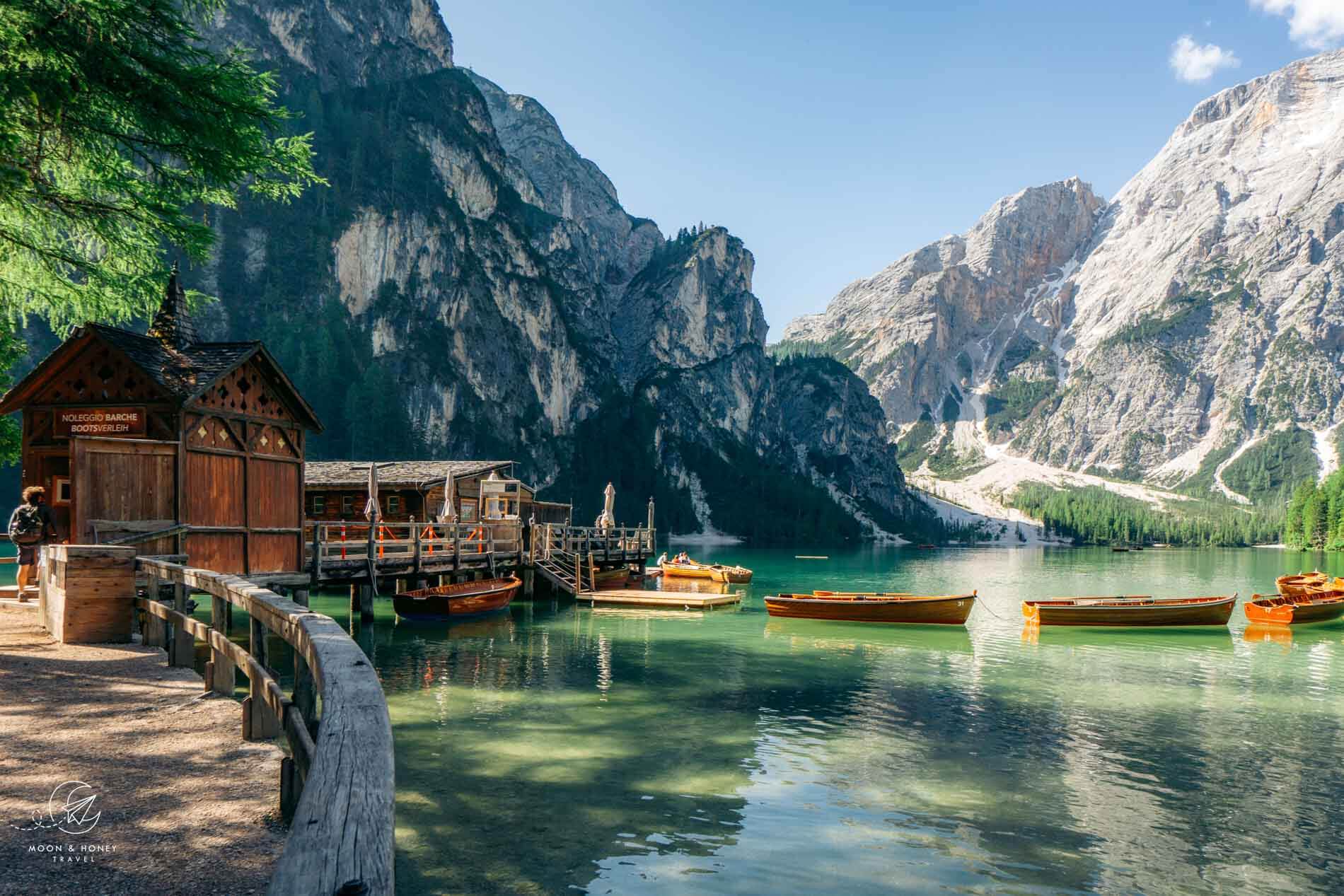
Stage 1: Lago di Braies – Rifugio Biella
Trailhead | Lago di Braies/Pragser Wildsee
Distance | 6.8 km
Time Needed | 3:30 hours
Elevation Gain | 916 meters
Elevation Loss | 62 meters
Difficulty | Moderate
Route | Lago di Braies – Rifugio Biella
Lunch Option | Rifugio Biella
Stay in Rifugio Biella
Rifugio Biella is a well-run, rustic mountain hut. We chose to stay here so we could summit Croda del Becco, but unfortunately, the weather made the summit attempt impossible. If you can, I would secure a night at Rifugio Sennes, the superior option in terms of comfort and quality of food.
Payment | Cash only
Showers | None
Drinking Water | No potable water
Half Board or à la carte | à la carte only
Rooms | Rooms with 4 beds

Stage 2: Rifugio Biella – Rifugio Fanes
Distance | 14 km
Time Needed | 4:30 hours
Elevation Gain | 583 meters
Elevation Loss | 872 meters
Difficulty | Easy
Route | Rifugio Biella – Berggasthaus Pederü – Rifugio Fanes
Lunch Option | You can grab a bite to eat at Berggasthaus Pederü.
The Alta Via 1 descends a wide track to Rifugio Sennes (1 hour) and then continues to descend all the way down to Berggasthaus Pederü, located at the head of Tamersc Valley (1:20 hours).
From here, the counter-ascent to Fanes Alps begins. It takes about 2:15 hours to reach Rifugio Fanes.
Stay in Rifugio Fanes
We stayed in Rifugio Fanes, but you can also stay in nearby Rifugio Lavarella or Ücia dles Muntagnoles.
Payment | Cash, or Credit Cards
Showers | Yes
Drinking Water | Tap water is safe to drink.
Half Board or à la carte | Both available. The food and wine menus are extensive.
Rooms | Dormitory and private rooms available

Stage 3: Rifugio Fanes – Rifugio Lagazuoi
Distance | 14.2 km
Time Needed | 5:30 hours
Elevation Gain | 1120 meters
Elevation Loss | 423 meters
Difficulty | Moderate
Route | Rifugio Fanes – Forcela dl Lech/Forcella di Lago – Lake Lagazuoi – Rifugio Lagazuoi
Lunch Option | None
Today’s stage begins by traversing the Fanes Alp. After 5.4 km (1:40 hours), the Alta Via 1 veers left on trail 20B. A steady ascent, increasingly rugged, brings you to Forcella di Lech. From here, the path steeply twists down to Lake Lagazuoi (300 meters of elevation loss), initially appearing far more treacherous than it actually is.
From Lake Lagazuoi, Trail 20 ascends to Forcella Lagazuoi and then continues on Trail 401 up a series of long switchbacks to reach the Lagazuoi cable car mountain station, located just below Rifugio Lagazuoi.
More Photos: Lake Lagazuoi Hike
Stay in Rifugio Lagazuoi
Rifugio Lagazuoi is an iconic mountain hut in the Dolomites. Because of its close proximity to a cable car, many people visit and overnight in this hut, without actually hiking here. So, that changes the atmosphere, naturally.
We arrived in Rifugio Lagazuoi in a snow blizzard. We were wet, frozen, and exhausted. Luckily, we could warm up in the hut’s tiny sauna, which fits 4 people. Sauna access costs 20 EUR per person and comes with a towel, bathrobe and a shower token.
Our only complaint about this hut was the dry room. It was way too small, and there wasn’t enough room for everyone’s shoes and clothing. So, we hiked in wet shoes the next day.
Payment | Cash, or Credit Cards
Showers | 3.50 EUR for 3 minutes
Drinking Water | No potable water
Half Board or à la carte | Both options available
Rooms | Private and dormitory rooms available

Stage 4: Rifugio Lagazuoi – Rifugio Nuvolau
Distance | 13 km
Time Needed | 5:15 hours
Elevation Gain | 957 meters
Elevation Loss | 1139 meters
Difficulty | Moderate
Route | Rifugio Lagazuoi – Forcella Travenanzes – Forcella Col dei Bos – Rifugio Dibona – Rifugio Cinque Torri – Rifugio Nuvolau
Lunch Option | Rifugio Dibona, or Rifugio Scoiattoli
There are several ways to hike from Rifugio Lagazuoi to Rifugio Nuvolau, or Rifugio Averau.
You can descend the Lagazuoi WWI Tunnels (or cable car) to Passo Falzarego and then ascend to Rifugio Averau via Lago di Limides and Forcella Averau.
Alternatively, you can hike across the northern slopes of Tofana di Rozes to Rifugio Dibona. From the hut, descend to the SR48 road and then resume the AV1 up to Cinque Torri and further up to Rifugio Scoiattoli, Rifugio Averau, or Rifugio Nuvolau.
More Photos: Cinque Torri and Rifugio Nuvolau
Stay in Rifugio Nuvolau or Rifugio Averau
Rifugio Nuvolau was the only hut along the AV1 that asked to see our passports. Tonight, you can also stay at Rifugio Averau (best option), Rifugio Scoiattoli, or Rifugio Cinque Torri.
Payment | Credit cards (minimum: 25 EUR), or Cash
Showers | None
Drinking Water | Tap water isn’t drinkable.
Half Board or à la carte | When you check-in, they ask you to order dinner between 5:30 pm and 6 pm.
Rooms | Dormitory only

Stage 5: Rifugio Nuvloau – Rifugio Città di Fiume
Distance | 12.7 km
Time Needed | 4:30 hours
Elevation Gain | 400 meters
Elevation Loss | 1050 meters
Difficulty | Moderate
Route | Rifugio Nuvloau – Passo Giau – Forcella Giau – Forcella Ambrizzola – Rifugio Città di Fiume
Lunch Option | Giau Pass Rifugio / You can also detour to Rifugio Croda da Lago for lunch
Hike down to Passo Giau, and then ascend to the Mondeval Plateau, bordered by Lastoni di Formin (Lastoi de Formin in Ladin), Croda da Lago, and Becco di Mezzodi. This is one of the most striking sections of the Alta Via 1. From Forcella Ambrizzola, the path turns south and descends steadily to Rifugio Città di Fiume (1:30 hours).
More Photos: Passo Giau to Mondeval Hike
Stay in Rifugio Città di Fiume
Payment | Credit cards, or cash
Showers | 3.50 EUR for 4 minutes
Drinking Water | Tap water isn’t potable.
Half Board or à la carte | Both available. You can choose when you arrive.
Rooms | Dormitory rooms only

Stage 6: Rifugio Città di Fiume – Rifugio Coldai
Distance | 9.3 km
Time Needed | 3:30 hours
Elevation Gain | 524 meters
Elevation Loss | 308 meters
Difficulty | Easy – Moderate
Route | Rifugio Città di Fiume – Rifugio Passo Staulanza – Malga Vescovo – Rifugio A. Sonino Al Coldai
Lunch Option | Rifugio Passo Staulanza
Follow trail 472 through larch forest and across scree, beneath Mount Pelmo, to Passo Staulanza (1 hour). Part of the path has been destroyed due to a rock fall.
From Passo Staulanza, follow the paved road for about 850 meters until you get to a bend with an array of trail signs indicating the direction of Malga Vescovo and Rifugio Coldai.
Behind the managed Malga Vescovo, the dirt trail angles steeply up the grassy slope. The trail connects to a gravel road that leads to Casera Pioda (old stable), where there’s a water source. From here, it’s a steep 319-meter ascent to Rifugio Coldai (~50 minutes). Hikers can choose between the well-graded serpentine path or the numerous shortcuts.
Stay in Rifugio A. Sonino Al Coldai
Rifugio Coldai, with its striking view of Mount Pelmo, is one of my favorite huts along Alta Via 1. However, its proximity to Lake Coldai and easy accessibility for day hikers mean that it can get quite crowded during the day.
Before you settle in, make sure to hike up to Lago Coldai. The lake is gorgeous in the late afternoon. We checked in, dropped off our bags in our room, and walked up to the lake before dinner.
Payment | Cash or card
Showers | 5 EUR for 6 minutes
Drinking Water | Tap water isn’t potable.
Half Board or à la carte | Half board only
Rooms | Dormitory, and private rooms available.
WIFI | Free

Stage 7: Rifugio Coldai – Rifugio Vazzoler
Distance | 9 km
Time Needed | 3:30 hours
Elevation Gain | 322 meters
Elevation Loss | 740 meters
Difficulty | Easy
Route | Rifugio A. Sonino Al Coldai – Forcella Coldai – Forcella Col Negro di Coldai – Cason di Col Rean – Rifugio Vazzoler
Lunch Option | Rifugio Attilio Tissi
This is a relatively short and easy stage, with no technical difficulty whatsoever. However, if it’s drizzling or raining, some stretches are extremely muddy. Some hikers will push on to Rifugio Carestiato, and even further to Passo Duran, but that’s quite ambitious.
This stage wraps around the eastern flank of the towering Civetta massif, first ascending to Forcella Coldai on a rugged, eroding scree path (Trail 560). Trails braid in several directions down and around Lake Coldai. Head to the lakeshore for the best view.
The path wraps around the lake basin and ascends to a minor saddle. A short traverse brings you to another saddle (Forcella Col Negro di Coldai – 2199 m), where the path soon divides. Take the lower right trail.
The undulating hike through Val Civetta is magnificent. If the weather is cooperative, definitely detour to Rifugio Attilio Tissi for lunch and nearby Cime di Col Rean (2281 m) for a bird’s-eye view of Lago di Alleghe.
Otherwise, press on to Forcella di Col Rean and continue hiking across Val Civetta.
The trail eventually descends to a wide mountain pasture, home to the dilapidated Cason di Col Rean, where I spotted a herdsman herding a flock of sheep with the assistance of his two dogs.
After Sella di Pelsa, you’ll soon drop below the timber line. Hike down the paved access road of Casa Favretti. The road, now gravel, descends and wraps around Torre Venezia and delivers you to Rifugio Vazzoler, located at the base of Val dei Cantoni.
Stay in Rifugio Vazzoler
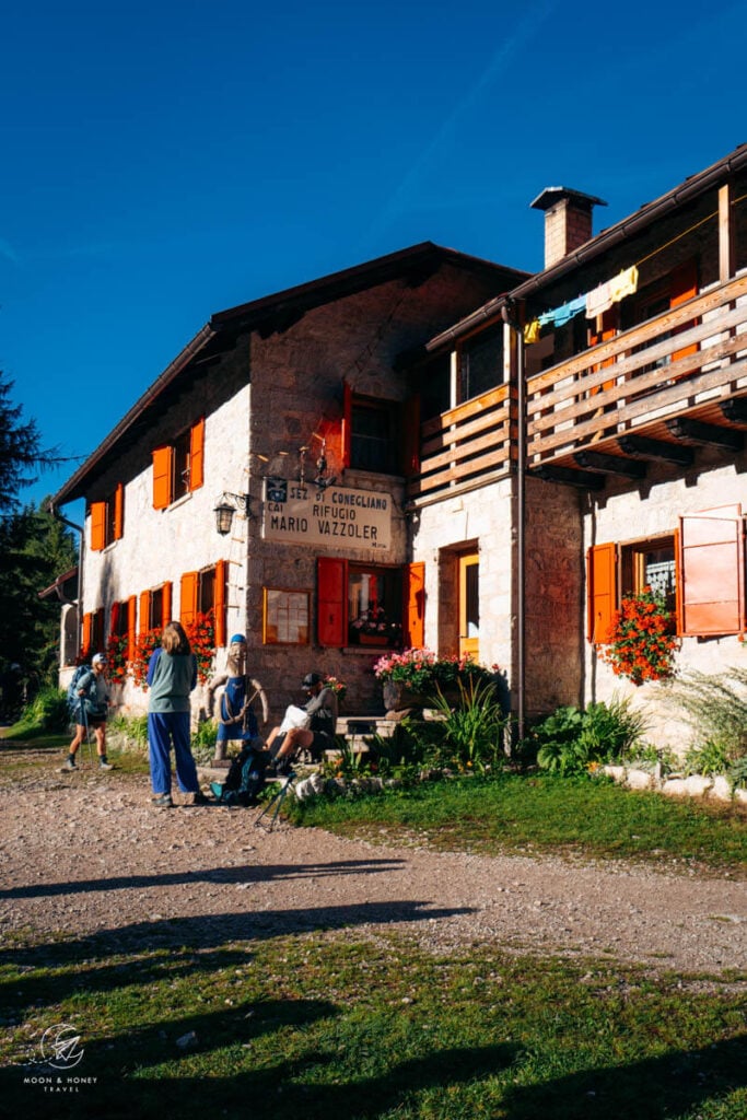
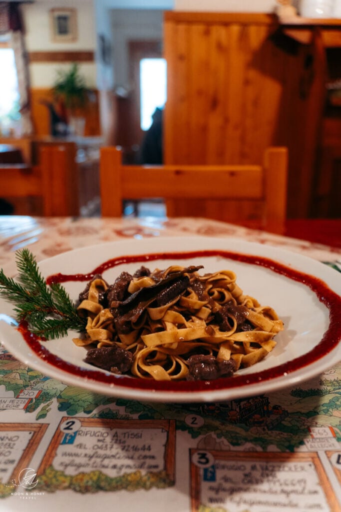
This is such a lovely hut, run by the friendliest staff. Given the moody, wet weather, they let everyone check-in early. I enjoyed my wild ragout lunch tremendously and everyone was praising the Venison goulasch.
Payment | Cash only
Showers | 3 EUR for a 3-minute hot shower / 3 showers for women and 3 showers for men
Drinking Water | The tap water is potable
Half Board or à la carte | Half board only
Rooms | Private and dorm rooms
WIFI | You have to purchase a WiFi package (1000 MB for 2 EUR or 300 MB for 1 EUR)
Stage 8: Rifugio Vazzoler – Rifugio Carestiato
Distance | 9 km
Time Needed | 4 hours
Elevation Gain | 582 meters
Elevation Loss | 462 meters
Difficulty | Moderately Difficult
Lunch | I ate lunch at Rifugio Carestiato
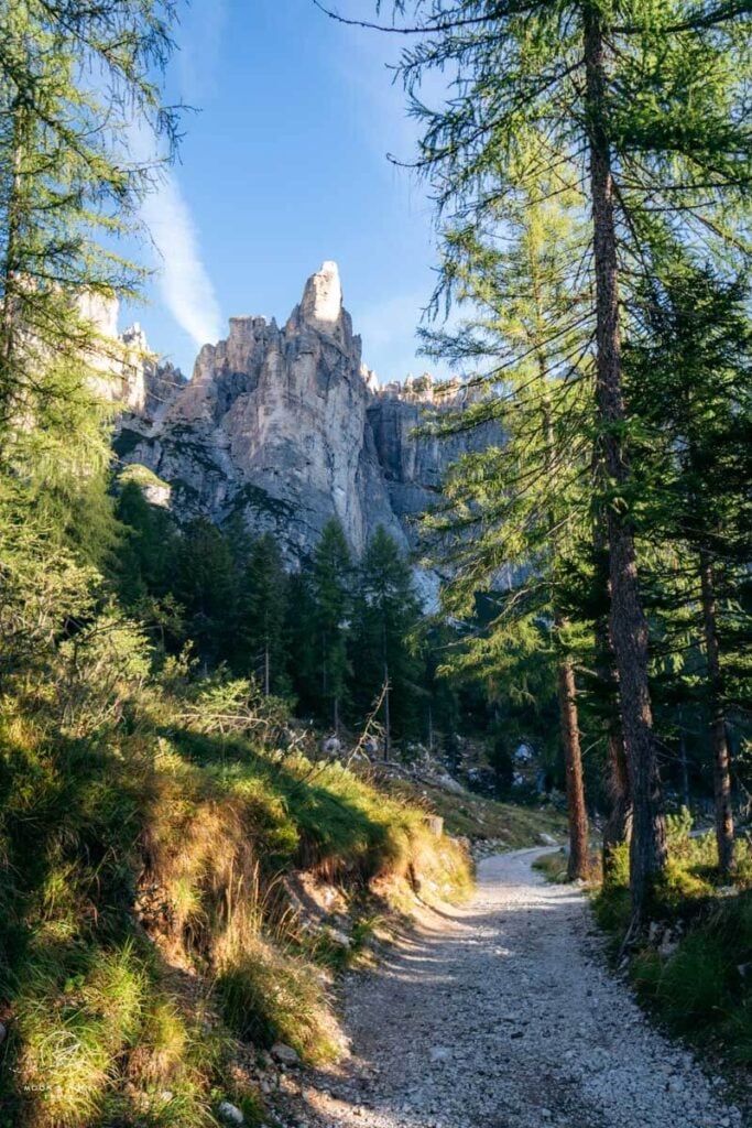
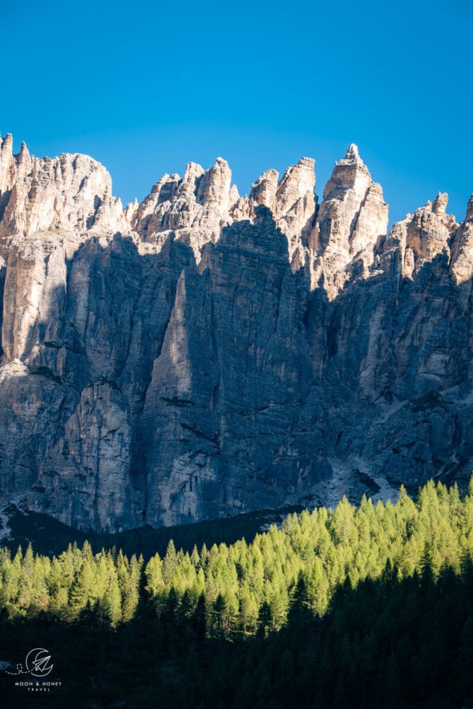
This is one of the most challenging stages of the Alta Via 1, due to the ruggedness of the terrain: boulder fields, scree, steep forest paths veined with tree roots.
This stage begins by descending a gravel road, Trail 555, which ultimately leads to Capanna Trieste and Listolade (possible exit route) in Val Corpassa.
After 35 minutes, the AV1 (Trail 554) branches off the road in the direction of Rifugio Carestiato, signed 3:30 hours.
The Alta Via 1 wraps around the Moiazza massif, following narrow and steep forest paths that are bisected by several scree gullies. There’s one badly eroded step early on, where the trail is broken off.
Beneath soaring walls, the trail crosses boulder fields and scree slopes, and steeply climbs up to a Forcella Co dell’Orso (1823 m). To crest the saddle, aim left and scramble up to the ledge, rather than head right through the rock corridor.
When the short cable-aided passage ends, the trail can be hard to detect. Try to maintain the same trajectory (keep your elevation). Like several others, I lost the trail and descended too far, only to have to clamber over boulders to rejoin it.
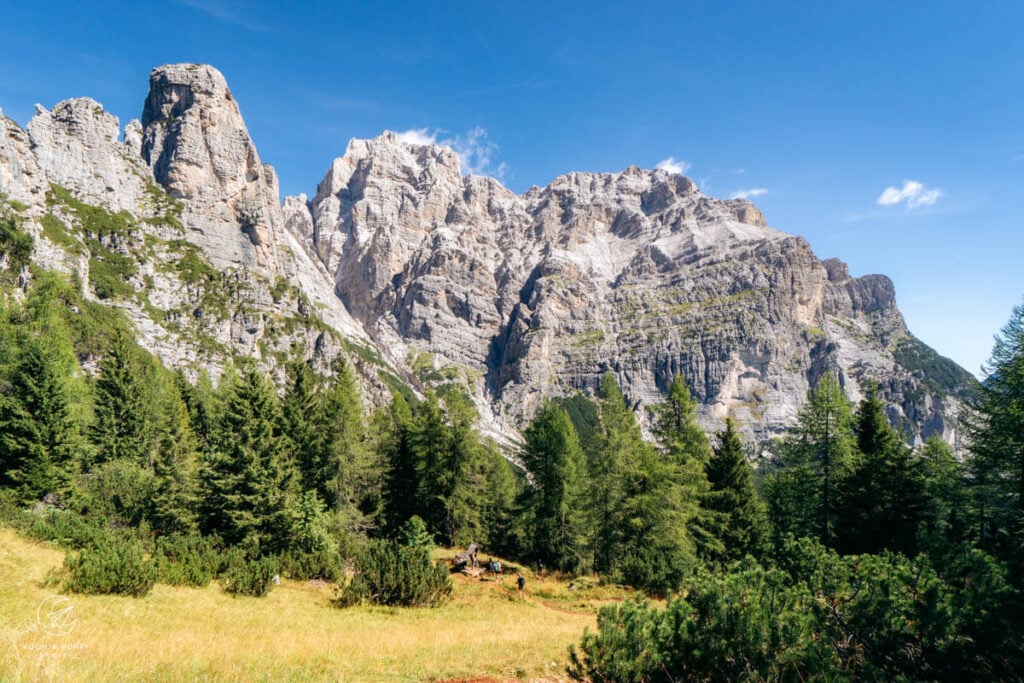
An easy traverse brings you to more woodland hiking and then an alpine pasture, grazed in summer. Cross the pasture to the rock wall, turn left and climb up to Forcella Del Camp, a great place for a break. From the saddle, there’s an incredible view of the Masende Crest.
The trail drops below the tree line and eases for a while. The final leg to the hut involves more boulder field and scree crossings, accompanied with views of the San Sebastiano-Tamer range in the distance. A final forest ascent brings you to the hut, which enjoys a dazzling perch with panoramic views.
Stay in Rifugio Carestiato or Passo Duran
Rifugio Carestiato is a charming refuge, especially lively in the afternoon, as Passo Duran-bound AV1 trekkers and day hikers stop here for lunch. I enjoyed their beetroot ravioli (Casunzei) very much!
Note: it is feasible to press on to Passo Duran (+45 minutes of easy walking). If you stay at Passo Duran, you can hike to Rifugio Fontana the next day, which will make your final day on the AV1 easier.
Payment | Card or cash. You only have to pay for the shower in cash.
Showers | There are 3 token-operated showers / 3 EUR for a 3-minute hot shower
Drinking Water | Tap water is not potable
Half Board | Half board only. Dinner is at 7 pm and breakfast is a 7 am
Rooms | Small and large dorm rooms
WIFI | Free. The password is displayed near the bar.
Stage 9: Rifugio Carestiato – Passo Duran – Rifugio Pramperet
Distance | 13.2 km
Time Needed | 4:45 hours
Elevation Gain | 592 meters
Elevation Loss | 564 meters
Difficulty | Moderate
Lunch | I ate lunch at Rifugio Pramperet, but I also consumed several trail snacks on this stage.
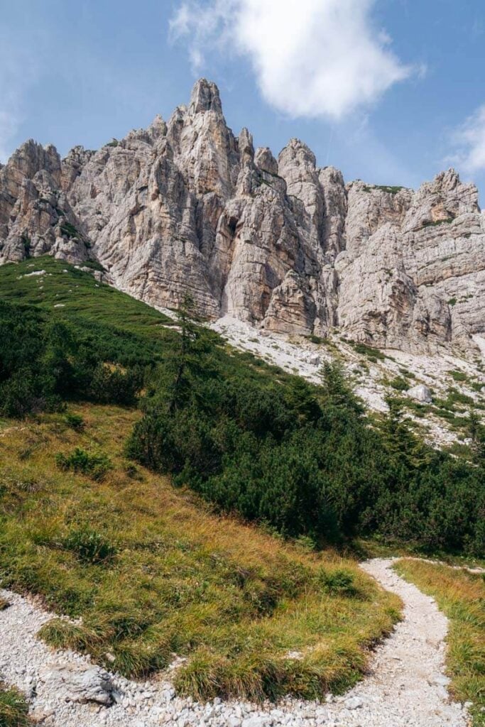
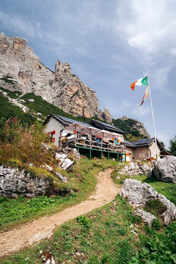
After a straightforward descent along a wide gravel track to Passo Duran (45 minutes), the AV1 follows the paved road south for 20 minutes, before entering the Dolomiti Bellunesi National Park. Follow the forest trail (#543) up to Forcella Dagarei (1620 m).
When the trail emerges from the forest, the path wraps around the Tamer massif. The lengthy traverse alternates between scree, boulder, and sturdy dirt paths. There are sweeping views of Castello di Moschesin ahead and Cordevole Valley off to the right.
Malga Moschesin, an unmanaged hut with a potable water source, invites you to take a break on one of its benches. The way continues up and around the south flank of Castello di Moschesin to Forcella del Moschesin (1940 m), marked by an abandoned barracks ruin. The AV1 (still trail #543) wraps around Cima de le Balanzole, initially descending and then rising up to a high meadow. The final meters to Rifugio Pramperet are blissfully flat.
Stay in Rifugio Pramperet
This rustic hut in Dolomiti Bellunesi National Park offers a few dormitory rooms, packed with bunk beds. Snag a bottom bunk so you don’t have to brave the sketchy ladders. If it’s windy, close the shutters before you go to bed.
Despite a wretched night’s sleep, courtesy of the banging shutters, I greatly enjoyed my time in this hut, thanks in no small part to the wonderful hikers I met here.
Payment | Cash is preferable
Showers | There’s one token-operated shower, which is available between 3:30 pm and 6:30 pm. It costs 5 EUR for a 2-minute hot shower.
Drinking Water | Tap water is potable
Half Board | Dinner at 7 pm / breakfast at 7 am. If you want to get an early start on the trail the next day, you can request a packed breakfast instead.
Rooms | Dorms only
WIFI | You can purchase 500 MB for 1 EUR
Stage 10: Rifugio Pramperet – La Pissa Bus Stop
Distance | 18.3 km
Time Needed | 8 hours
Elevation Gain | 893 meters
Elevation Loss | 2296 meters
Difficulty | Difficult
Lunch | Rifugio Fontana and Rifugio Bianchet
Of all the Alta Via 1 stages, this was my favorite, particularly the section between Rifugio Pramperet and Rifugio Pian de Fontana. The trail has more of a high-alpine quality compared to the previous stages, making it more challenging, but also more interesting. It’s also remarkably quiet and beautiful. I spotted several chamois in Van de Zita de Fora.
The downside of this stage is the very long descent (2296 meters). I intentionally started early (7:30 am) and took long breaks throughout the day, so that I didn’t have to rush the descent.
Rifugio Pramperet – Rifugio Fontana (3 hours)
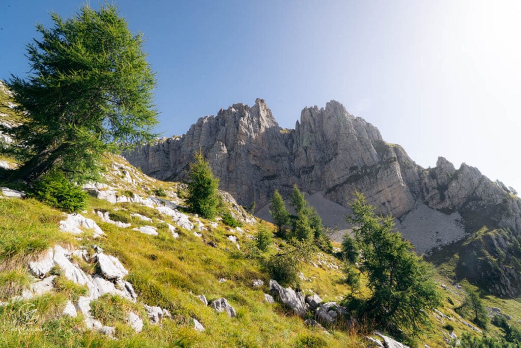
To start the final stage, initially backtrack along yesterday’s trail for about 500 meters, bear left on Trail 514, and then ascend to Portela del Piazedel, 2097 meters (45 minutes).
From the saddle, veer left and hike up karst slabs. The way is marked with fading waymarks and cairns. The trail is increasingly rocky and steep, but after 25 minutes it eases and then climbs up a grassy slope to reach a narrow ridge. Turn left and scramble up the ridge (light exposure). The path soon broadens and eases. After a scree traverse, you’ll reach Forcella de Zita Sud, where the trail sign indicates 1:50 hours to Rifugio Fontana.
The trail slithers down the gorgeous high valley of Van de Zita de Fora. This is one of the most spectacular moments along the Alta Via 1. The descent continues in stages without any difficulty, with the exception of a few steep rock steps. The trail plummets down to Rifugio Fontana. Part of the way is secured with fixed cables, which are likely useful in wet conditions.
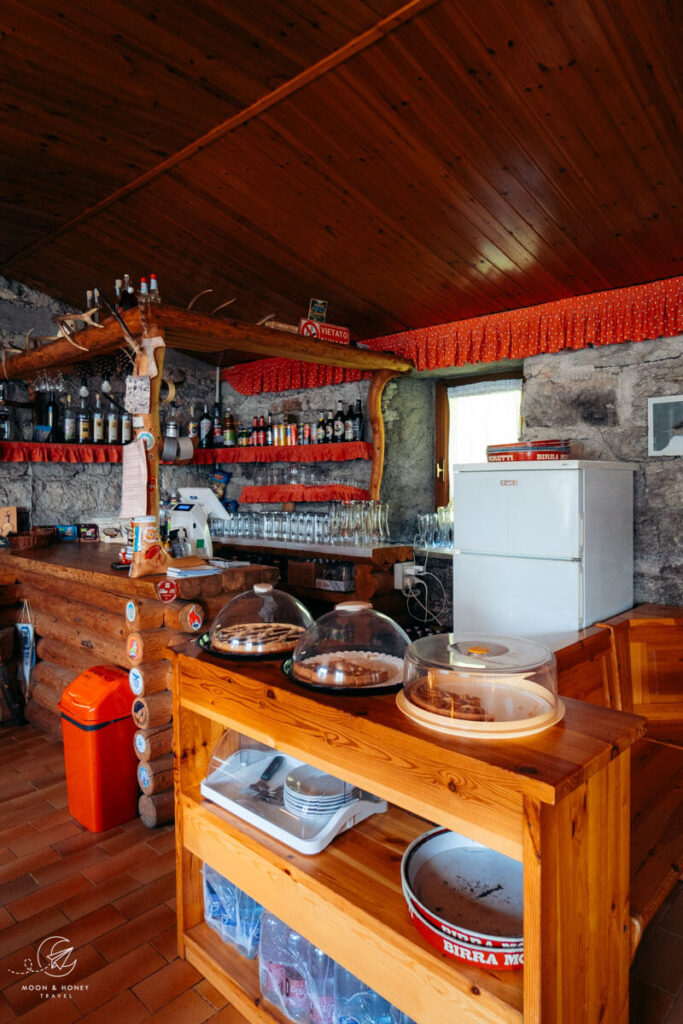
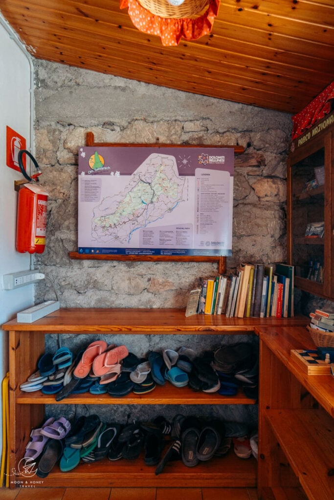
I ordered a mint tea and a cake and took a much-needed 30 minute break in this cozy hut (cash only, no internet).
Rifugio Fontana – Rifugio Bianchet (2 hours)
Initially, the trail descends into a beech forest. After crossing a stream, turn right in the direction of Rifugio Bianchet and ascend the beech forest. Well-graded switchbacks bring you up to Forcella La Vareta, located on a wide grassy meadow with a cautionary sign about vipers.
A long, magnificent balcony traverse ultimately leads to Trail 518, the start of the steady, serpentine descent to Rifugio Bianchet.
Rifugio Bianchet (cash only, no potable water, no internet) is a nice place to rest and eat lunch, before completing the AV1.
Rifugio Bianchet – La Pissa Bus Stop (2 – 2:15 hours)
The majority of the descent follows a very comfortable, well-graded road down a beech forest in Val Vescova. There are some wonderful views of sheer forested cliffs as you approach Val Cordevole.
Eventually, the AV1 trail veers left, leaving the main road, and drops down a rather steep and narrow forest path (direction: Fondovalle Fermata autobus) to a cement staircase, just above the busy SR203 road (25-30 minutes). Turn right and follow the highway until you see the La Pissa Bus Stop (5 minutes). It’s a rather anticlimactic ending to such a gorgeous hike.
La Pissa – Belluno
From La Pissa, there are bus connections to Belluno and Agordo. Please check the Dolomiti bus timetable in advance.
You can purchase the bus ticket onboard (cash only).
Look for accommodation in Belluno.
Explore the Dolomites
Dolomites Travel:
- Where to Stay in the Dolomites in Summer
- Best Things to Do in the Dolomites
- Best Places to Visit in the Dolomites
- Best Day Hikes in the Dolomites
Hut to Hut Hiking Trails:
Dolomites Destinations:
- Val Gardena
- Ortisei, Val Gardena
- Val di Funes
- San Martino di Castrozza
- Alpe di Siusi
- Puez-Odle Nature Park
More Treks in Europe:

Pin this Image for Future Trip Planning!
Stay Connected:
Connect with us on Pinterest.
Follow us on Instagram.
Like us on Facebook.
Support Us:
If you love reading our content, you can buy us a coffee via Ko-Fi.

the majority of the refigi you list have no potable water? Where does one get water for hut to hut travel on the Alta Via 1?
Hi Brond,
Many huts have drinking water. If there’s no potable water, the hut will sell bottled water.
Happy trails,
Sabrina
Hey thanks so much for all this detail, super helpful. We did UTMB in 6 days (semi running) in 2025, I am now planning dolomites for 2027 with a group. We were doing 30km+ days in mt Blanc, do you have a suggested optimum route for alta via 1 to go faster? Looks like the first two stages of what you did are possible. Do you have a suggestion for a faster full length trip, doing as long as possible but with longer days and where to stop?
Hi Richard,
We’re not trail runners, so I hesitate to offer any advice here. I wish you best of luck figuring out an ideal trail running AV1 itinerary.
Kindly,
Sabrina
Hi! Would you be able to describe your transfer from Listolade to Alta Badia? We are planning to do exactly this: exit from Rifugio Vazzoler to Listolade bus stop, take a bus to Alta Badia, and to Selva.
I’m finding it difficult to navigate the route to Alta Badia from Listolade, the route planners give 7-15 hours with multiple changes.
How long did it take you to get to Alta Badia from Listolade, did you change or manage with one bus ride? Thanks so much!
Hi Ella,
We took one bus from the Listolade bus stop to Corvara (via Alleghe). The bus ride is about 1 – 1:30 hours. I recall that there were very few departures. I can’t locate a timetable for the summer. You may need to email the local tourism offices, or even Albergo Ristorante Monte Civetta (located across the bus stop) to find out when the buses depart.
Best of luck!
Sabrina
Hi Sabrina and Kati~ I don’t have a question but wanted to say that this is a wonderful guide and I appreciate the time and effort you put into it! Everything included was important to know without being overwhelming. I am visual so tying in the photos and map helps me plan as well. It can be difficult to sort through all the media, posts, and blogs out there for someone like me that is not often an international traveler. This blog and your instragram account are inspiring me to overcome my hesitancy in planning trips to beautiful places even though it seems daunting at first. I am excited to start with the AV1 and will keep following along on your journeys for ideas for my next trip!
Thank you so much Olivia for reading our blog! Wishing you a memorable trip along the Alta Via 1.
-Sabrina