Sassongher (2665 m) looms large over Corvara in Alta Badia. Naturally, anyone who has an itch for peaks will want to summit this striking, pyramidal-shaped peak in Puez-Odle Nature Park.
This hike is only suitable for hikers who are comfortable with exposure, erosion, and loose rocky terrain. The final leg involves unsecured and secured scrambling (Grade A/B). Bring a via ferrata kit!
- Trailhead: Col Pradat paid car park, Colfosco | Google Maps
- Distance: 8 km out-and-back
- Time Needed: 4:30 hours / I needed 4:45 hours with breaks
- Elevation Gain/Loss: 1089 meters
- Difficulty: Difficult
- Lowest Point: 1719 meters
- Highest Point: 2665 meters
- Trails: 4, 4A and 7
- Where to Stay in Colfosco: Ciasa Altonn (apartments), Crëp Sella (3-star), Hotel Jägerhof (3-star)
- Recommended Itinerary: 10-14 Day Dolomites Itinerary
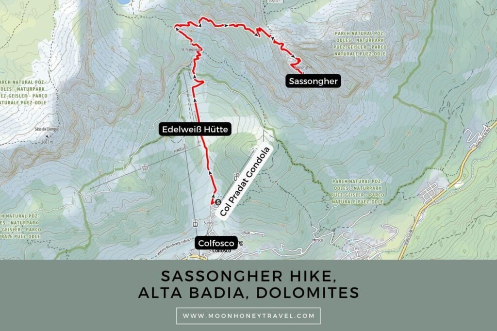
Sassongher Hiking Map
Essential Trail Info
Trailhead | You can start this hike anywhere in Colfosco. If you’re driving, I recommend parking at the Col Pradat lift valley station car park. You can pay for parking using a credit card or EUR coins.
Hiking Season | July – September, when the trail is snow-free
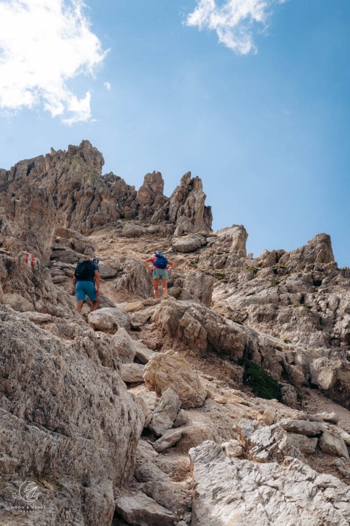
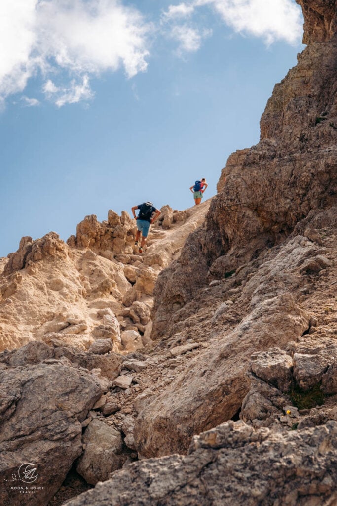
Difficulty | When approaching Sassongher from Edelweiss Valley, the vast majority of the ascent is straightforward and moderate. However, the final climb from Forcella Sassongher to the summit is challenging, involving a very rough trail that is broken off in several places. Along the way, there is also a short secured section (Grade A/B).
Trail Variation – Col Pradat Lift | It’s possible to start the hike with the Col Pradat lift, but I decided against it because Trail 4A was closed due to a landslide. With the closure, hikers have to follow Trail 3 instead, which initially involves losing elevation. Taking the lift therefore saves only about 100 meters of elevation gain/loss. The real advantage of starting and ending with the Col Pradat lift is the opportunity to feast at Rifugio Col Pradat after the hike.
Trail Variation – Gardenaccia Approach | Sassongher can also be approached from the Gardenaccia Plateau. Take the Gardenaccia chairlift from La Villa, then hike to Rifugio Gardenacia, and then follow Trail 5 to Forcella Sassongher.
Where to Eat | Edelweiss Hütte or Rifugio Col Pradat
Responsible Hiking | This trail is located within the UNESCO World Heritage Site Puez-Odle Nature Park, a protected nature park. Wild camping, flying drones, picking flowers, and lighting fires is forbidden.
Sassongher Trail Description
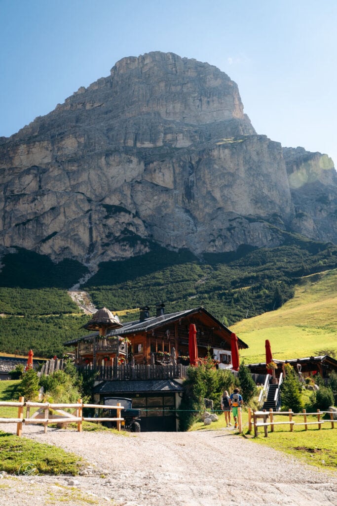
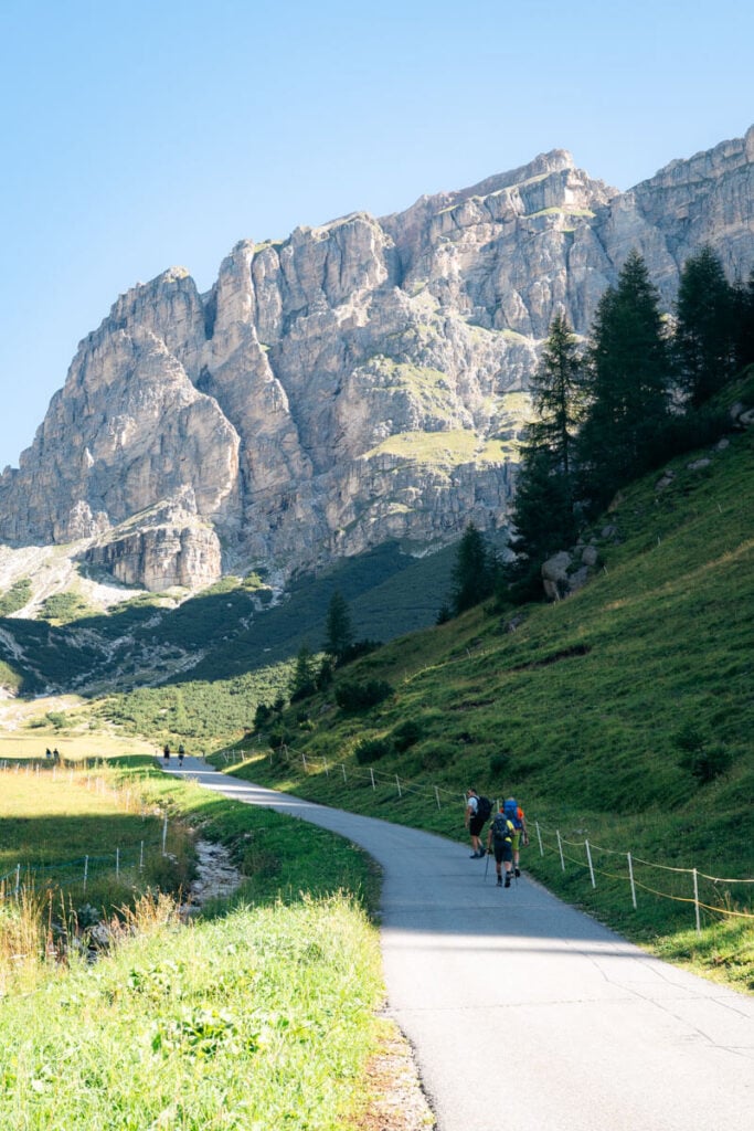
Follow Trail 4 up Edelweiss Valley in the direction of Sassongher (signed 3:10 hours), initially along a paved road and then up a grassy slope. Along the way, you’ll pass Edelweiss Hütte and cableways and snow cannons of Alta Badia’s ski resort.
The trail climbs steeply in a series of switchbacks, with Trail 3 and later Trail 4A joining the route along the way.
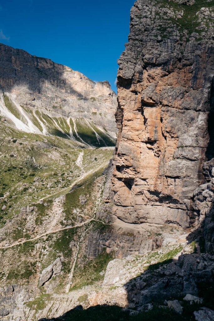
At the junction, turn right onto Trail 7, following the signs for Sassongher (1:50 hours). The trail then traverses a beautiful ledge-balcony path, with breathtaking views of the Sella massif.
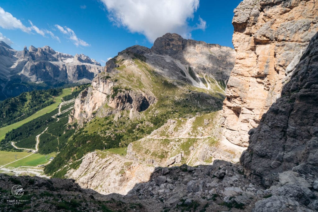
From here, a series of switchbacks, reinforced with timber, leads up to Forcella Sassongher (2,411 m), at the foot of the summit.
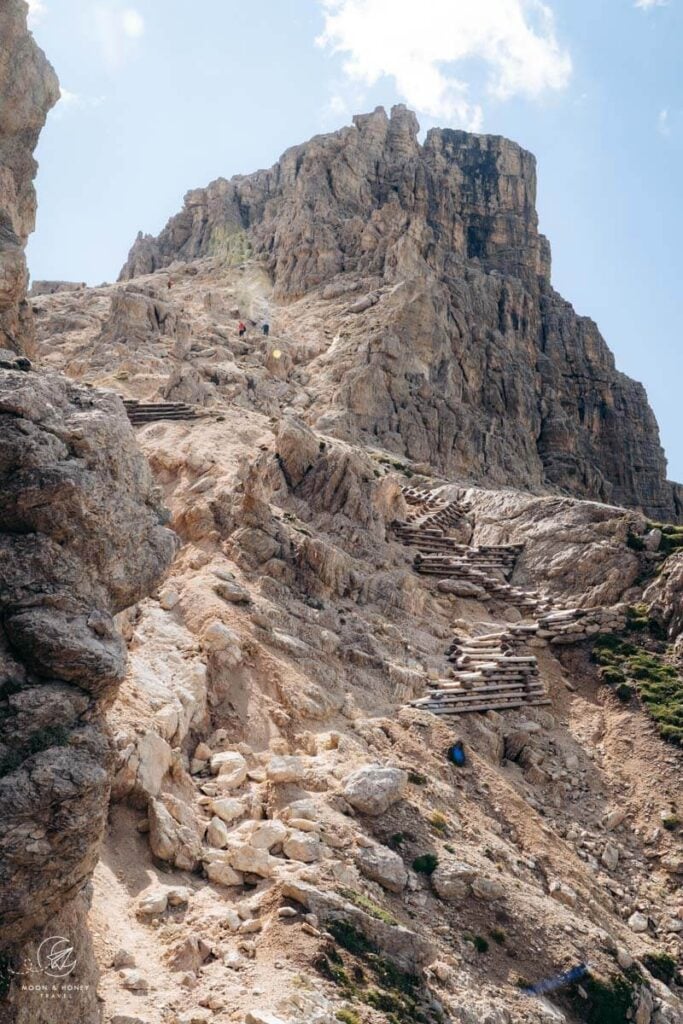
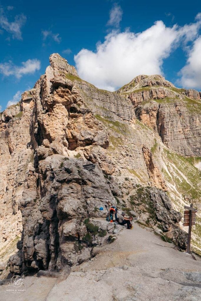
From the forcella, hike up the steep path over loose scree, which has a sandy consistency in places. The trail is extremely rough and badly eroded, with several sections partially washed out, so take care as you pick your way across the broken terrain.
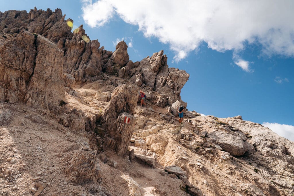
A short cable-aided section follows. Although nearly vertical, it’s well secured. Beyond the fixed cable route, the trail eases as it wraps around the mountain.
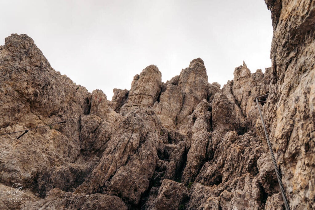
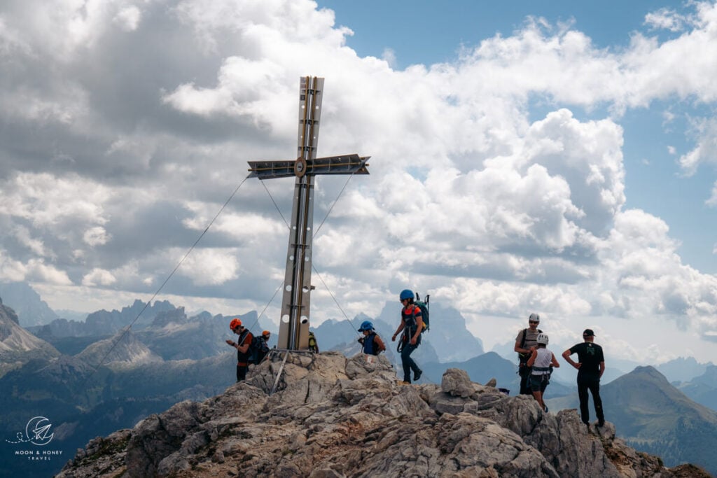
The path then turns right and traverses a slope that is again heavily eroded before reaching the ridge. From here, the final few meters to the summit cross are straightforward.
Where to Stay in Alta Badia
Colfosco
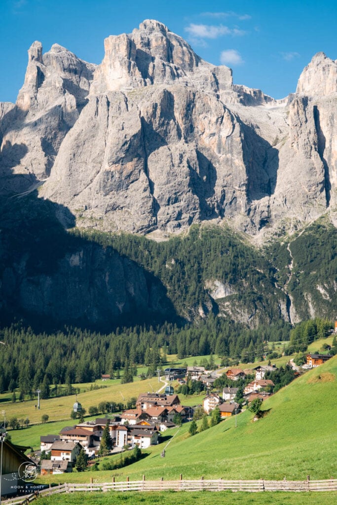
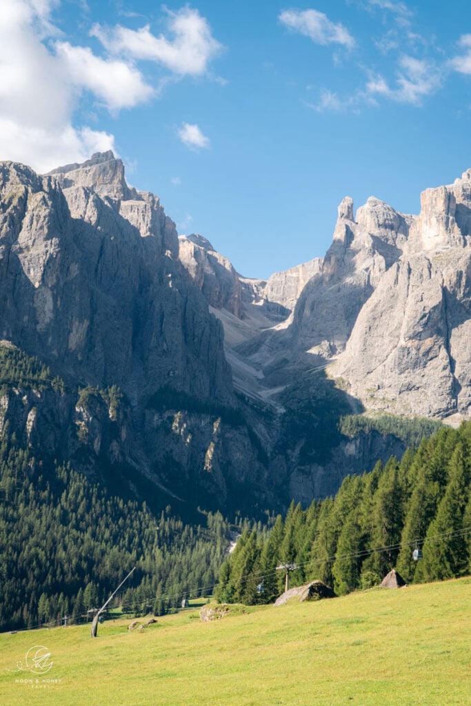
Colfosco is the starting point of numerous hikes including the Pisciadu Waterfall Trail, Colfosco High Trail, Edelweiss Valley to Puez-Odle Plateau, and of course Sassongher. I recommend Ciasa Altonn (budget-friendly apartments), Residence Costa Burjada (budget-friendly apartments), Crëp Sella (3-star B&B), Hotel Jägerhof (3-star hotel and restaurant), Hotel Tabladel (3-star hotel with half board), and Mountain Hotel Mezdi (4-star hotel).
Corvara
Take a look at these Corvara town center accommodations, all within walking distance of the Boè and Col Alt cable cars: Residence Villa Trieste (apartments), Hotel Marmolada (4-star hotel), Ciasa De Munt Lifestyle Living (4-star hotel), Berghotel Ladinia (guesthouse with restaurant), and Hotel La Perla (5-star hotel).
If you’re traveling by car, also check out accommodations in the Pescosta hamlet above Corvara: Residence Angelika (3-star hotel) and Hotel Pradat (3-star hotel).
Learn More: Where to Stay in Alta Badia
Dolomites Travel Guides
Alta Badia Travel:
Val Badia Hikes:
- Störes Meadows, Pralongia Plateau Hike (easy)
- Path of the Larches (easy)
- Armentara Meadows Hike (easy)
- Lake Lagazuoi Hike (moderate)
- Sass da Ciampac Summit Hike (moderate)
- Rifugio Puez Hike (moderate)
- Rifugio Fanes Hike (moderate)
- Lungiarü – Ütia Ciampcios (moderate)
- Sass de Putia Circuit Hike (moderate)
- Lake Pisciadù Hike (difficult)
Via Ferrata Routes around Alta Badia:
- Gran Cir (Grade A)
- Lichtenfelsersteig: Vallon to Piz Boè (Grade A)
- Kaiserjägersteig to Lagazuoi (Grade A)
Dolomites
Pin this Image for Future Trip Planning!
Stay Connected:
Connect with us on Pinterest.
Follow us on Instagram.
Like us on Facebook.
Support Us:
If you love reading my content, you can send me a direct donation.