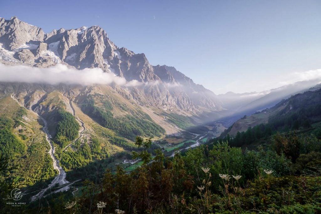
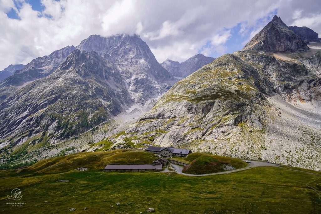
Stage 6 of the Tour du Mont Blanc from Rifugio Bertone, Italy, to La Peule, Switzerland, unfolds like a dream. It’s a breathtaking stage full of magical landscapes. Without question, this was my favorite stretch of the Tour du Mont Blanc.
High above Val Ferret, the TMB traverses the north flank of Mont de la Saxe to Rifugio Bonatti.
After a leisurely start, the TMB descends to the valley bed and then steadily climbs up to Rifugio Elena and further up to the Grand Col Ferret (2537 m) saddle. Here, the Tour du Mont Blanc crosses into Switzerland.
Grand Col Ferret is the highest point of the classic Tour du Mont Blanc circuit. However, Fenêtre d’Arpette along the variant route on stage 8 is 128 meters higher.
We ended the stage at Gîte Alpage de La Peule, a rustic mountain pasture hut with a single large dormitory. It was the least comfortable sleeping arrangement we experienced along the TMB. However, the food was generous and very good.
Unfortunately, there’s no viable alternative, other than pressing on to Ferret, which would add 2.8 km to an already very long day.

- Starting Point: Rifugio Bertone, Italy
- Ending Point: La Peule, Switzerland
- Distance: 21.2 km point-to-point
- Time Needed: 7 – 8 hours
- Elevation Gain: 1167 meters
- Elevation Loss: 1279 meters
- Difficulty: Moderately difficult because of the length
- Minimum Elevation: 1778 meters
- Maximum Elevation: 2537 meters
- Where to Stay: Gîte Alpage de La Peule
- Self-Guided Hiking Tour: 10-Day Standard Tour du Mont Blanc (what we booked)
Rifugio Bertone to La Peule Trail Map
Rifugio Bertone – Gran Col Ferret – La Peule Trail Description
Rifugio Bertone to Rifugio Bonatti (2:15 hours)

The way to Rifugio Bonatti cuts across the flank of Mont de la Saxe, high above Val Ferret. There’s a TMB variant that follows the crest of Mont de la Saxe, which is only feasible if you shorten the stage (e.g. by staying in Rifugio Elena).
From the refuge, follow the trail uphill. Soon you’ll reach a signed junction. Turn left to Refuge Bonatti (2:15 hours), Rifugio Elena (4:40 hours), and Col Gran Ferret (6:10 hours).
Follow this undulating balcony path across patches of forest, mountain pastures, meadows, and streams.
This leisurely traverse is accompanied with staggering views of Les Grandes Jorasses.

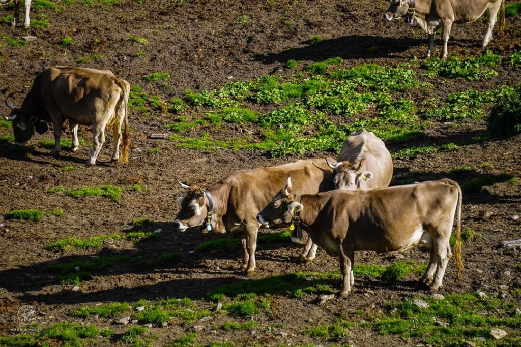
The TMB crosses the pastures of Leuchey, Leche, and Arminaz, and Sécheron, where cattle graze freely in summer. Maintain a respectful distance from the animals, even if it means venturing off trail in order to do so.
The undulating path continues northeast until reaching a junction just below Rifugio Bonatti. Turn right and ascend to the refuge.

Rifugio Bonatti is another splendidly located mountain hut along the Tour du Mont Blanc. If needed, take a break here, use the restroom, and fill up your water (a trough fountain is located near the picnic tables).
Rifugio Bonatti to Hotel Chalet Val Ferret (1:30 hours)

Hike up the slope to the Malatra alp huts and head left.
After a few stream crossings, continue northeast towards the head of Val Ferret.
After about an hour from Rifugio Bonatti, the trail makes a sharp left turn at two stone huts and descends to the valley floor of Val Ferret.
Follow the sign to Rifugio Elena (1:30 hours).
Chalet Val Ferret is located just off the trail and is a great option for lunch and/or refreshments. The kitchen doesn’t open until 12:30 pm, but you can order snacks and drinks in the bar.
Hotel Chalet Val Ferret to Rifugio Elena (50 minutes)

Follow the road up the valley for several minutes to the trail junction. The TMB branches off to the right and ascends immediately.
The ascent to Rifugio Elena alternates between steep and level passages. Throughout this stretch, there are splendid views of massive walls, towering peaks and cascading glaciers.
As you draw close to Rifugio Elena, the path eases considerably.
Rifugio Elena is built into the hillside. From its terrace, views extend across the valley to Aiguille de Tricot (3858 m), Mont Dolent (3819 m) and Glacier de Pré de Bard.
Rifugio Elena (2066 m) is an ideal place for lunch on today’s stage. Their bean soup was bursting with flavor.
Rifugio Elena to Grand Col Ferret (1:10 – 1:25 hours)

The ascent continues steadily up to Grand Col Ferret (2537 m), the highest point along today’s stage.
As you hike up the hillside, it’s tempting to walk backwards in order to drink in the staggering views of Rifugio Elena dwarfed by the massive, towering mountains. The views of Val Ferret are equally impressive.

After conquering 471 meters of elevation gain, the trail levels and glides to the saddle.
Grand Col Ferret to La Peule (1 hour)

Grand Col Ferret (2537 m) marks the border between Italy and Switzerland.
The drama somewhat dissipates as you slide across the border.
But, it’s an enjoyable path nonetheless with absolutely no difficulty. The dirt path gently cuts across slopes and descends to the alpine dairy farm at La Peule.

As you draw near the alpine pasture, you’ll likely hear cow bells.
Stay in Gîte Alpage de La Peule

Alpage de la Peule is an active summer mountain pasture (Alp/Alm). It’s very enjoyable to end the day here with a beer, whilst listening to cowbells. However, the two-story dormitory is quite rustic and the shower and bathroom facilities leave something to be desired. The upside is that the food is quite good.
Check-in | The check-in was easy and swift. We were able to check-in as soon as we arrived (4 pm).
Rooms | 1 large dormitory only.
Payment | Swiss Francs (CHF). They will also accept EUR, but may not be able to give you exact change.
Dinner | The dinner was excellent and very generous. We were served a salad, a cheese-bread-ham casserole, and a fruit salad. Dinner is served at 6:30 pm. Vegetarians eat 30 minutes before.
Breakfast | A breakfast buffet (yogurt, cheese, homemade bread) is laid out at 7 am.
Lunch Packet | None available
Drinking Water | Yes
Electronic Charging Stations | Minimal charging possibilities
Toilets | There are only two toilets located across from the communal wash basin (where everyone brushes their teeth). There’s no privacy.
Showers | There’s no extra charge to use the shower. Expect a very basic set-up. Because the space is quite tight, only bring essentials into the shower area (so your things don’t fall).
Hut Rules | Remove hiking boots and place them in the white tent outside of the main building.
Tour du Mont Blanc Essential Info
Read our Tour du Mont Blanc Hiking Guide to start planning your trek.
Quick Facts
- Official TMB Length: 170 km (105 miles)
- Days Needed: 10-11 days
- Which Direction to Hike: Counterclockwise
- Where to Start the TMB: Chamonix, Vallée de l’Arve, France
- Closest Airport to Chamonix: Geneva Airport, Switzerland
- When to Hike the TMB: July – early September
- When to Book the TMB: January – February
- TMB Difficulty: Moderate
- Recommended Self-Guided Tours: 10-Day Standard Tour du Mont Blanc (private and shared rooms), 11-Day Tour du Mont Blanc Itinerary (comfort package available), 7-Day Tour du Mont Blanc (shortened route with transit shortcuts), 14-Day Tour du Mont Blanc (leisurely-paced route).
TMB Planning Resources
- TMB Hiking Guidebook: Cicerone: Trekking the Tour of Mont Blanc guidebook
- TMB Trail Maps: L’Escursionista Tour du Mont Blanc TMB or IGN Tour du Mont Blanc Map
Tour du Mont Blanc Route Itinerary
The Tour du Mont Blanc (TMB) is a captivating multi-day hike that circuits the Mont Blanc massif in usually 10-11 days, passing through France, Italy and Switzerland. Here’s our personal TMB itinerary.
- Stage 1: Chamonix – Le Brévent – Les Houches
- Stage 2: Les Houches – Les Contamines-Montjoie (Col de Tricot Variant)
- Stage 3: Les Contamines – Refuge de la Croix du Bonhomme
- Stage 4: Refuge de la Croix du Bonhomme – Cabane du Combal (Col des Fours Variant)
- Stage 5: Cabane du Combal – Courmayeur – Rifugio Bertone
- Stage 6: Rifugio Bertone – Grand Col Ferret – Alpage de La Peule
- Stage 7: Alpage de La Peule – Ferret – La Fouly – Champex-Lac
- Stage 8: Champex-Lac – Trient (Fenêtre d’Arpette Variant)
- Stage 9: Trient – Col de Balme – Aiguillette des Posettes – Tré le Champ
- Stage 10: Tré le Champ – Lac Blanc – La Flégère – Chamonix
More Europe Hiking Guides
European Alps:
Multi-Day Hikes in Europe:
Hut to Hut Hiking:


