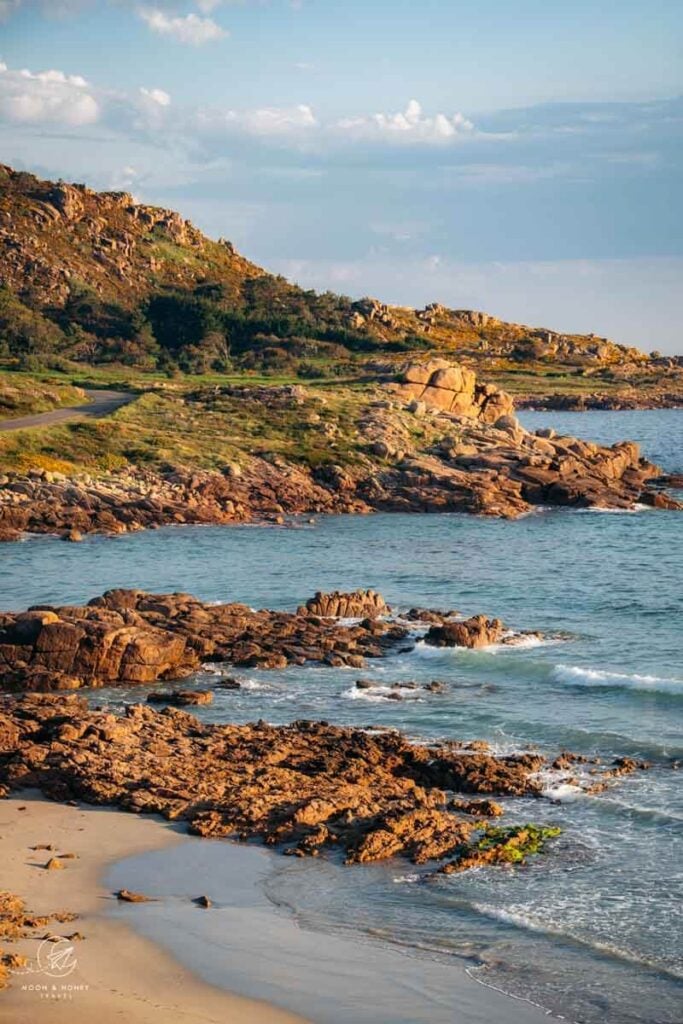
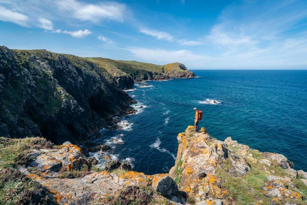
The Camiño dos Faros, or Lighthouse Way, is an exhilarating multi-day coastal trek in Galicia, Northern Spain. The trail traces the remote Costa da Morte, or Coast of Death, celebrated for its rugged beauty and infamous for the countless shipwrecks that inspired its name.
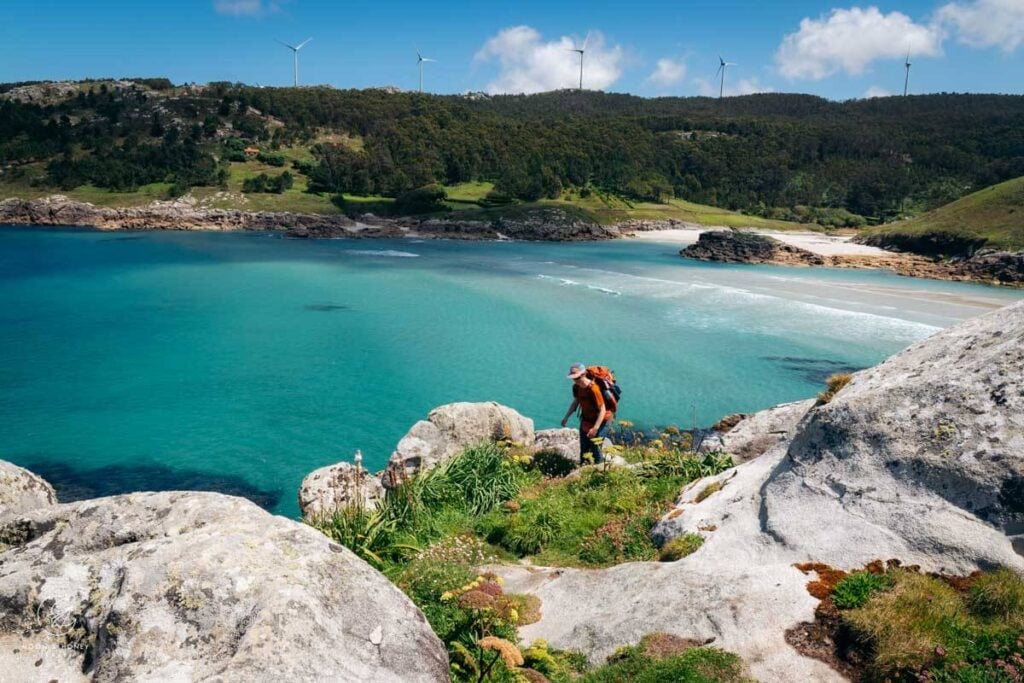
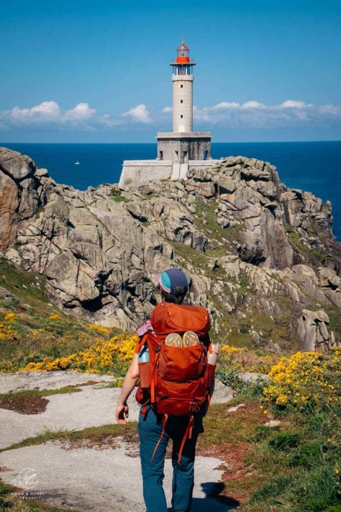
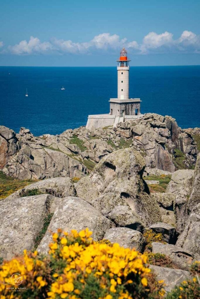
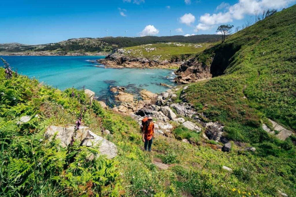
From Malpica to Finisterre, this village-to-village route leads hikers from lighthouse to lighthouse, across cliffs, boulders, sanddunes, forests, and beaches, rarely departing the coast. Much of the Lighthouse Way follows narrow footpaths still used by fisherman and percebes harvesters today.
Divided into 8 stages, this 200-km trail is tough, requiring a great deal of stamina. If you approach the Lighthouse Way with some flexibility (shortcuts and taxi support), it can be far more manageable. When it comes to hiking, I’m no purist; I believe every hiker should choose what serves them best.
I can’t recommend this coastal trail highly enough; it’s adventurous, comfortably affordable, blissfully quiet, and unbelievably varied. The main drawbacks of the Lighthouse Way are its long daily distances and the uncertainty surrounding its future.
- Starting Point: Malpica
- Ending Point: Finisterre (Fisterra in Gallego)
- Distance: 200 km
- Time Needed: 8 days
- When to Hike: Late spring, or early autumn
- Where to Stay: Hotels, Apartments, and Guesthouses
- Wild Camping: Wild camping is prohibited along the Camiño dos Faros, as the trail passes entirely through the Red Natura 2000 protected areas.
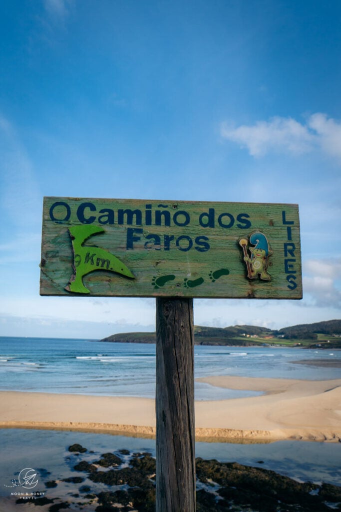
- Pilgrimage Route: Camiño dos Faros is not a pilgrimage trail, however hikers will intersect with pilgrims trekking the Camino Finisterre in Muxía, Lires, and Cape Finisterre (Cabo Fisterra). The final two stages of each trek follow parallel routes but do not overlap.
- Guidebook: Walking the Camino dos Faros
Camiño dos Faros History & Status
Heads up: This section of the guide is long, but it’s essential reading if you want to understand the current status of the trail.
A Love Letter to Galicia
The Camiño dos Faros was born from a bold idea: trace every rugged curve of Galicia’s Costa da Morte from Malpica to Fisterra entirely along the seafront.
On December 7, 2012, six friends set out to forge this path across wind-battered cliffs, linking hidden coves and beaches with remote fishing villages. Their grassroots project became a one-of-a-kind coastal trail and a love letter to one of Spain’s wildest coastlines.
In 2013, these friends founded the O Camiño dos Faros Association, with the goal of seeking GR accreditation in order to formalize the route’s status, promote the Coast of Death as a sustainable destination, improve the trail with GR waymarking, and protect the coast from potential threats (e.g. speculation).
Bureaucratic Nightmare
For 8 years, the association worked diligently to certify the route, meeting and working with numerous government agencies and institutions:
- 9 municipalities
- Provincial Council
- Xunta de Galicia
- Tourism of Galicia
- CMAT (Cultural and Environmental Management)
- Xunta’s Environment Department
- Galician Mountaineering Federation
- State Coasts
- Ports of Galicia
- Port Authority of A Coruña
Despite the association’s best efforts, the project was thwarted by bureaucracy. In 2020, the group, frustrated and disappointed by multiple obstacles engineered by all these institutions and entities formally disassociated itself from the role of promoter of the trail.
The year before, in 2019, the Camiño dos Faros association submitted the Environmental Document (Documento Ambiental) to Xunta de Galicia, as part of the approval process. Though the law requires a response from Xunta de Galicia within 3 months, they didn’t get a response until 6 years later (March 2025).
According to an article in Faro de Vigo, the Dirección Xeral de Patrimonio Natural mandates fifteen changes to the current path, especially in protected natural areas and habitats of vulnerable species.
Sadly, these trail alternations would effectively destroy the Camiño dos Faros as we know it (read about it here). The fact is many of the proposed changes are absolutely absurd. In some cases, the proposed changes would force hikers to skirt certain beaches, even though swimmers, sunbathers, volleyball players, and other beachgoers face no such restrictions.
With government investment (e.g. boardwalks across sand dunes), there would be no need to re-route the trail in most cases.
The Future of the Trail
Kati and I hiked the Camiño dos Faros in May 2025, unaware of this ongoing bureaucratic struggle until a reader kindly sent us this article published in June 2025, asking us to advocate for the original route. Unfortunately, we don’t have any affiliation with the O Camiño dos Faros Association.
In this article from 2020, the Camiño dos Faros Association wrote: “Although it’s not approved, the route is, de facto, a public good and is so widely promoted by society at all levels that, even if we wanted to, we couldn’t stop it.”
Like the association, I believe that the route will live on. However, it’s impossible to predict what condition the trail will be in a few years from now, given that no organization is responsible for its maintenance or signage. My advice is to hike it as soon as possible. And, please do not attempt this trail without offline maps preloaded with GPX tracks.
Camiño dos Faros Difficulty
Camiño dos Faros is a difficult long-distane trail due to the daily distances, the undulating nature of the path, the terrain at times, and the inconspicuous waymarking. Additionally, some official route stages are impractical, as they don’t end at an accommodation (more on that later).
Navigation
The official color of the Camiño dos Faros is bright green, which, as you might expect, often blends into the lush landscape. Green dots, arrows, and footprints mark trees, rocks, boulders, and pavement.
Although the trail is well-marked, it’s still easy to lose your way due to the subtle green waymarks. Downloading offline maps and GPX tracks for this trail is essential.
Daily Distances
Most days involve roughly 25 km of hiking. However, some stages will be much more than that. For example, stage 6 from Camariñas to Muxía is 34.2 km by our calculation (32.6 km on the official website).
Hikers can take a few shortcuts to reduce distances, and it’s always possible to skip certain sections by taxi. During our trek, we took two taxis to allow extra recovery time and skip some of the more tedious stretches along the estuaries.
Overgrown Areas
Some paths are overgrown with fern and gorse. In spring, the blooming gorse transforms the landscape into a stunning sea of yellow, making its prickly thorns almost forgivable. But honestly, those thorns are extremely irritating. I’m glad I wore long pants every day.
Water
On some remote stages, there are no water fountains, eateries, or shops. You’ll need to source water from streams and carry a filtration system. If that’s not an option, plan to carry 3 liters per person on these remote stages.
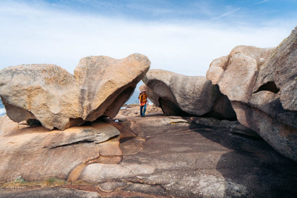
Boulders
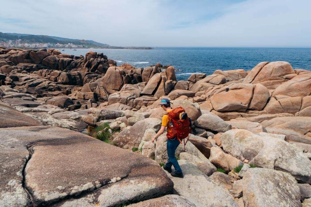
Much of the Coast of Death is strewn with granite boulders. Along the route, you’ll come across numerous sections where scrambling over rocks with your hands is necessary. This adds excitement to the trail, but also increases its difficulty.
Cumulative Elevation Gain
Many stages feature constant ups and downs. Although this isn’t mountain hiking, it can feel like it, especially on days with a cumulative elevation gain of 755 meters (stage 6) and 900 meters (stage 7).
For those unaccustomed to a heavier pack, the undulating trail can be tough. It was for us. While no single luggage transfer service covers the entire route, it is possible to arrange transfers for each stage. I’ll explain how later.
Safety
Hiking this trail felt very safe for us, as two hikers, as women, and as a queer couple.
It’s important to know that this trail is remote and you will go long stretches without seeing anyone. Although many people hike this trail solo, I wouldn’t feel comfortable doing so: not because it’s unsafe, but because in the event of an accident, help could be far away.
We did not encounter any aggressive dogs along the trail. There were a few farm dogs around Touriñán (stage 6), but they were always accompanied by herdsmen.
Also, we didn’t come across any bothersome, frightening, or unusually large insects.
Camiño dos Faros Route
Official Route
The official route is divided into eight stages and is typically hiked from Malpica to Cape Finisterre, traveling northeast to southwest. If you plan to hike the entire trail without shortcuts, I strongly recommend scheduling a rest day in Muxía at the very latest.
- Stage 1: Malpica – Praia de Niñóns (21.3 km)
- Stage 2: Praia de Niñóns – Ponteceso (27.1 km)
- Stage 3: Ponteceso – Laxe (25.3 km)
- Stage 4: Laxe – Arou (18 km)
- Stage 5: Arou – Camariñas (23. 8 km)
- Stage 6: Camariñas – Muxía (32.6 km)
- Stage 7: Muxía – Praia de Nemiña (25. 3 km)
- Stage 8: Praia de Nemiña – Cape Finisterre (26.9 km)
Our Lighthouse Way Route
In practice, it’s not feasible to finish stage 1 in Praia de Niñóns, as there are no nearby accommodations. We chose to end stage 1 in Barizo instead, which created a domino effect on stages 2 and 3.
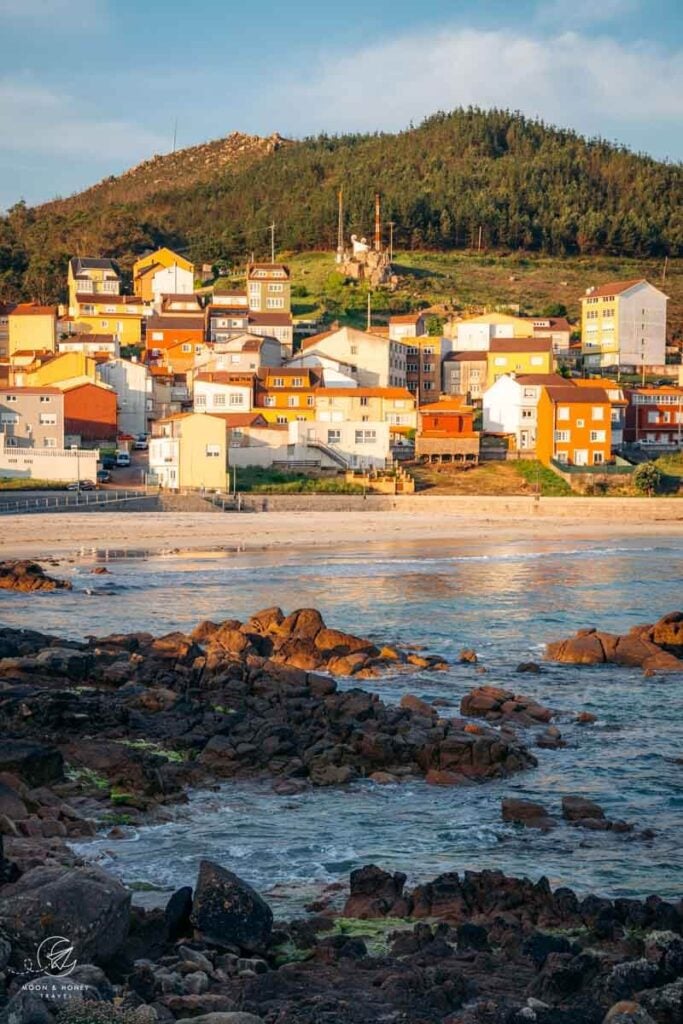
Stages 4 and 5 work well as designed. Stage 6 is a beast and considered the least interesting stage of all, so we cut it out completely. For stage 7, I think it makes more sense to end in Lires, as there are more accommodation options.
Stage 8 ends at Cape Finisterre, where the only lodging option is the pricey Hotel El Semáforo de Finisterre, which requires booking well in advance. For us, staying there felt like a fitting, ceremonial conclusion to the Lighthouse Way, but for many hikers this won’t be practical given the hotel’s limited capacity.
- Day 1 | Transit Day: A Coruña to Malpica. We stayed in Fonte Do Fraile.
- Day 2 | Stage 1: Malpica to Barizo (12 km). We stayed in Casa da Vasca.
- Day 3 | Stage 2: Barizo to Corme (25.5 km). We stayed in Apartamentos Playa de Osmo.
- Day 4 | Stage 3: Corme to Laxe (25.7 km). We stayed in O Náutico Laxe sea view.
- Day 5 | Stage 4: Laxe to Camelle (15. 3 km). We stayed in O Refuxio do Náufrago.
- Day 6 | Stage 5: Camelle to Camariñas (27 km). We stayed in O Mar de Preciosa.
- Day 7 | Stage 6: Camariñas to Muxía (34.2 km). We stayed in Albergue Bela Muxía.
- Day 8 | Stage 7: Muxía to Lires (30 km). We stayed in LIRESCA.
- Day 8 | Stage 8: Lires to Cape Finisterre (22 km). We stayed in Hotel El Semáforo de Finisterre. Alternatively, stay in Fisterra: Hotel Costa Da Morte, PORTO REAL HOTEL
- Day 9 | Transit Day: Fisterra > Santiago de Compostela > A Coruña
- Day 10 | Departure Day
Getting to the Lighthouse Way Starting Point: Malpica
The official starting point is Malpica, located in the province of A Coruña in the autonomous region of Galicia in Northern Spain.
The closest airports to Malpica are A Coruña Airport and the Santiago-Rosalía de Castro Airport near Santiago de Compostela.
While A Coruña Airport is closer to the starting point, Santiago-Rosalía de Castro Airport is closer to the end of the route. So, there’s no real advantage to choosing one over the other.
From the A Coruña Airport
If you fly into the A Coruña Airport, there are two main ways to reach Malpica:
Option 1 | Take three buses.
- Take bus 4051/A4 from A Coruña Airport to Coruña E.A. (Estación de Autobuses)
- Take a second bus from Coruña E.A. to Carballo
- Take a third bus from Carballo to Malpica (Malpica de Bergantiños)
Bus schedules are synced with Google Maps, but I recommend confirming timetables on bus.gal. Because there’s no direct line between Coruña E.A. and Malpica, make sure to select “Con transbordo” under “Transbordos” in the journey planner.
The transit journey from Coruña E.A. to Malpica with a transfer in Carballo takes around 3 hours.
Option 2 | Book a private transfer.
Kati booked us a private transfer with sunny transfers from A Coruña Airport to our accommodation in Malpica, and it was worth every one of the 84 EUR we spent. The added comfort and convenience made the start of our trip far more enjoyable and stress-free.
From the Santiago-Rosalía de Castro Airport
If you fly into Santiago–Rosalía de Castro Airport, the same two options apply: public transit or a private transfer. If you opt for transit:
- Take bus line 6A from Santiago-Rosalía de Castro Airport to Santiago city center.
- From Santiago, take a bus to Carballo.
- From Carballo, take a local bus to Malpica (Malpica de Bergantiños).
Leaving Cape Finisterre
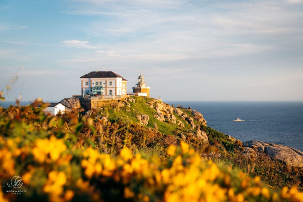
The Camiño dos Faros officially ends at Cape Finisterre, 3.2 km away from the village of Finisterre (Fisterra). After staying the night in Hotel El Semáforo de Finisterre at Cape Finisterre, or in Fisterra, make your way to the Fisterra bus station (Google Maps).
From Fisterra village, there’s a direct bus to the Santiago de Compostela bus and train station (Google Maps). If you’re flying out of Santiago, hop on bus line 6A to the airport. If you’re flying out of A Coruña, you can either continue your journey by bus, or by train to Coruña.
Kati prebooked the bus to Santiago but didn’t reserve the train to A Coruña. We ended up waiting two hours for the next train with available seats.
In hindsight, I wish we had booked a private transfer from Cape Finisterre to our hotel in A Coruña. Instead, we walked to Fisterra, took a bus to Santiago, then a train to A Coruña, and finally a taxi to our hotel. A private transfer would have saved time and energy, giving us more opportunity to explore A Coruña, a truly vibrant and beautiful city.
Responsible Hiking
Wild Camping | Officially, wild camping is not allowed along the Camiño dos Faros, because the entire trail runs through the Red Natura 2000 network, which encompasses protected natural areas in the European Union. There are very few official campgrounds along the trail, so I don’t recommend camping. Accommodations are plentiful and affordable, making an inn-to-inn approach the best way to hike this route.
Support Local Communities | Support local businesses–cafés, guesthouses, shops–rather than relying solely on supplies you bring.
Bring Two Reusable Water Bottles | The tap water is safe to drink. Refill your water bottles whenever possible instead of buying single-use plastic bottles. My favorite water bottle for hiking is SIGG – Shield ONE.
Stay on the Marked Trail | Much of the route traverses fragile coastal ecosystems. Avoid creating new paths or cutting across vegetation.
More Hikes in Europe
Coastal Multi-Day Hikes:
- Fisherman’s Trail in Portugal
- South West Coast Path in England
Treks:
Hiking in Spain:
- Our Favorite Hikes in Spain
- Best Hikes in Tenerife
- Best Hikes in Mallorca
- Best Hikes in Picos de Europa
- Best Hikes in Gran Canaria

Pin this Image for Future Trip Planning!
Stay Connected:
Connect with us on Pinterest.
Follow us on Instagram.
Support Us:
If you love reading our content, send me a direct donation.

